MyTopo
Goltry Oklahoma US Topo Map
Couldn't load pickup availability
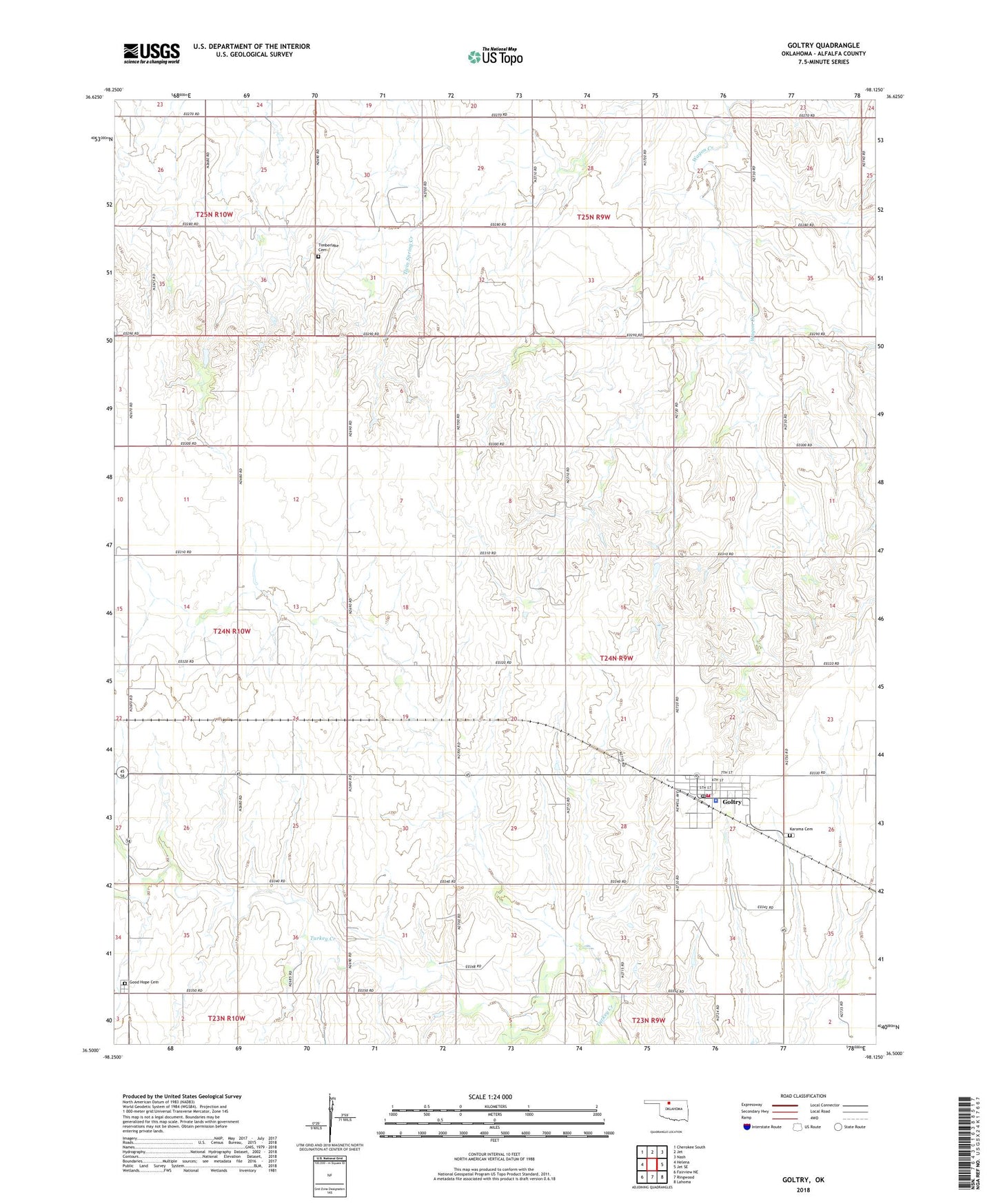
2022 topographic map quadrangle Goltry in the state of Oklahoma. Scale: 1:24000. Based on the newly updated USGS 7.5' US Topo map series, this map is in the following counties: Alfalfa. The map contains contour data, water features, and other items you are used to seeing on USGS maps, but also has updated roads and other features. This is the next generation of topographic maps. Printed on high-quality waterproof paper with UV fade-resistant inks.
Quads adjacent to this one:
West: Helena
Northwest: Cherokee South
North: Jet
Northeast: Nash
East: Jet SE
Southeast: Lahoma
South: Ringwood
Southwest: Fairview NE
This map covers the same area as the classic USGS quad with code o36098e2.
Contains the following named places: Goltry, Goltry Fire Department, Goltry Police Department, Goltry Post Office, Good Hope Cemetery, Helena Division, Karoma Cemetery, Timber Lake Church, Timberlake Cemetery, Town of Goltry, Township of Karoma, ZIP Code: 73739