MyTopo
Lahoma Oklahoma US Topo Map
Couldn't load pickup availability
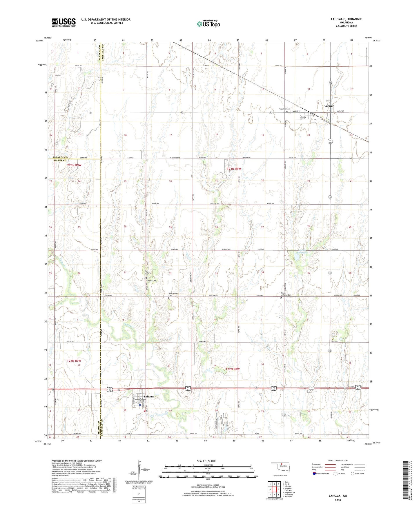
2022 topographic map quadrangle Lahoma in the state of Oklahoma. Scale: 1:24000. Based on the newly updated USGS 7.5' US Topo map series, this map is in the following counties: Garfield, Major, Alfalfa. The map contains contour data, water features, and other items you are used to seeing on USGS maps, but also has updated roads and other features. This is the next generation of topographic maps. Printed on high-quality waterproof paper with UV fade-resistant inks.
Quads adjacent to this one:
West: Ringwood
Northwest: Goltry
North: Jet SE
Northeast: Hillsdale
East: Enid West
Southeast: Waukomis
South: Drummond
Southwest: Ringwood SW
This map covers the same area as the classic USGS quad with code o36098d1.
Contains the following named places: Baumagartner Cemetery, Black I Ranch Airport, Carrier, Carrier Post Office, Cimarron Elementary School, Cimarron High School, Lahoma, Lahoma Cemetery, Lahoma Fire Department, Lahoma Police Department, Lahoma Post Office, Oknoname 04702 Dam, Oknoname 04702 Reservoir, Rose Hill Cemetery, Town of Carrier, Town of Lahoma, Township of Hobart, Township of Logan, Trinity Church, Trinity Lutheran Cemetery, Vernon School, Zion Lutheran Cemetery, ZIP Codes: 73727, 73754