MyTopo
Gore Oklahoma US Topo Map
Couldn't load pickup availability
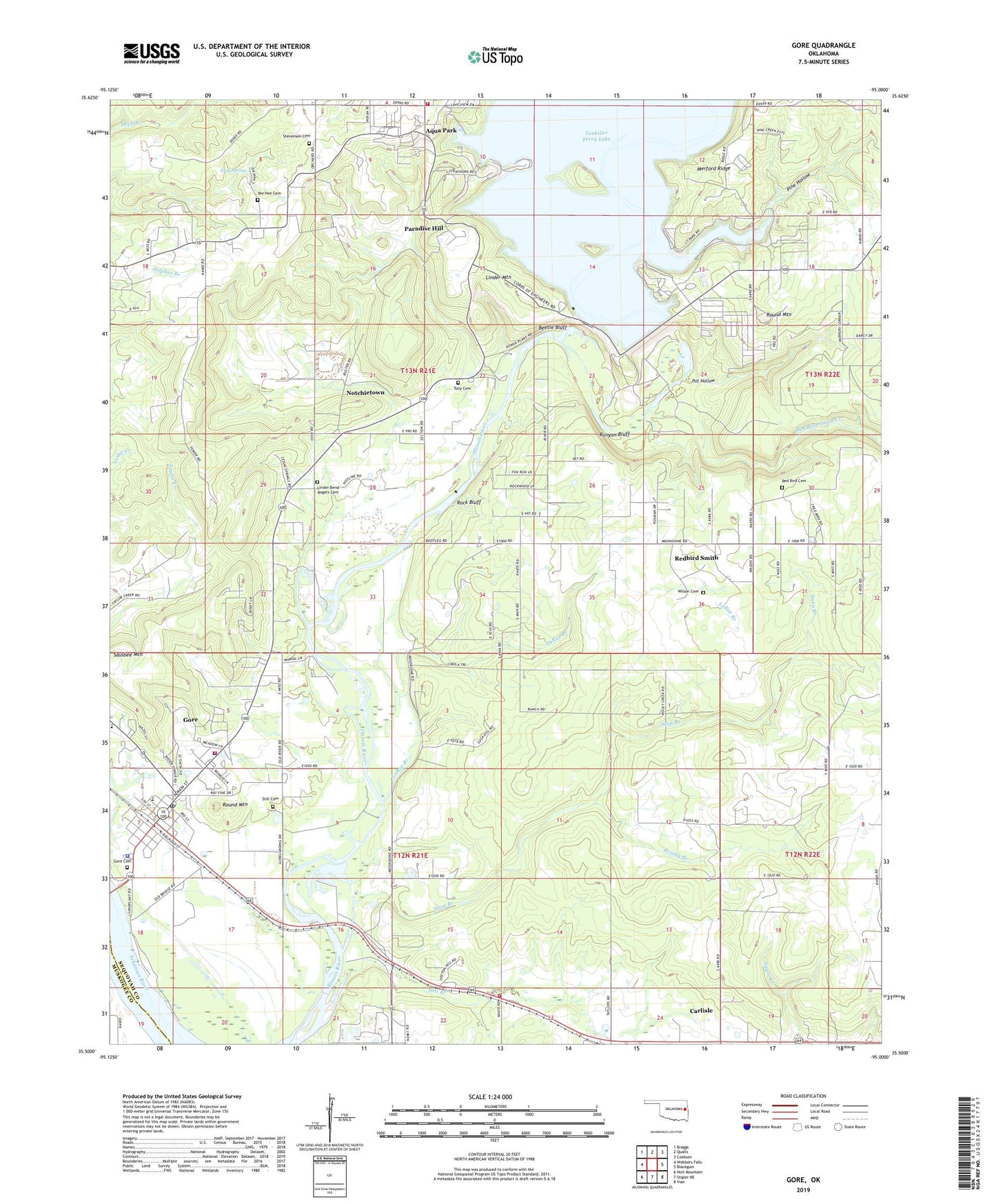
2019 topographic map quadrangle Gore in the state of Oklahoma. Scale: 1:24000. Based on the newly updated USGS 7.5' US Topo map series, this map is in the following counties: Sequoyah, Muskogee. The map contains contour data, water features, and other items you are used to seeing on USGS maps, but also has updated roads and other features. This is the next generation of topographic maps. Printed on high-quality waterproof paper with UV fade-resistant inks.
Quads adjacent to this one:
West: Webbers Falls
Northwest: Braggs
North: Qualls
Northeast: Cookson
East: Blackgum
Southeast: Vian
South: Stigler NE
Southwest: Holt Mountain
Contains the following named places: Aqua Park, Beetle Bluff, Brushy Branch, Carlile School, Carlisle, Carlisle Census Designated Place, Cedar Spring Church, Deep Branch, Fin and Feather Resort Heliport, Gates Family Cemetery Gumsprings, Gore, Gore Cemetery, Gore Elementary School, Gore Fire Department, Gore High School, Gore Landing, Gore Police Department, Gore Post Office, Gore Upper Elementary School, Gum Spring, Gum Spring Church, Gum Spring School, Horse Shoe Bend, LaRue Branch, Linder Bend, Linder Bend School, Linder Bend-Rogers Cemetery, Linder Mountain, McClellan-Kerr Wildlife Management Area, Merford Ridge, Notchietown, Notchietown Census Designated Place, Notiechtown, Pine Creek Cove State Park, Pine Hollow, Pot Hollow, Red Bird Smith Creek, Redbird Cemetery, Redbird Smith, Redbird Smith Census Designated Place, Rock Bluff, Round Mountain, Runyan Bluff, Rural Fire Protection District 1 Sequoyah, Salt Branch, Sausbee Mountain, Stevenson Cemetery, Still Cemetery, Strayhorn Landing Public Use Area, Tenkiller Dam, Tenkiller Ferry Dam, Tony Cemetery, Town of Gore, Town of Paradise Hill, Township of Campbell, West Tenkiller Fire Department, Wilson Cemetery, ZIP Code: 74435