MyTopo
Holt Mountain Oklahoma US Topo Map
Couldn't load pickup availability
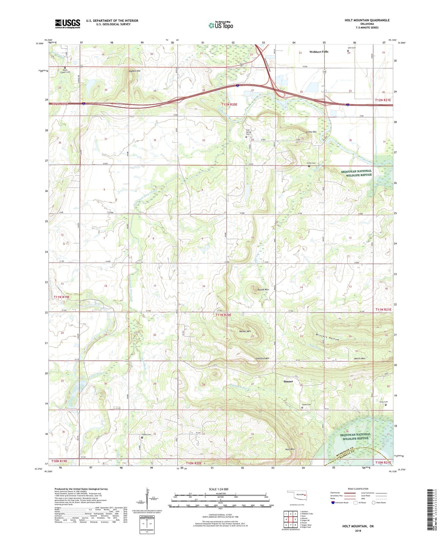
2022 topographic map quadrangle Holt Mountain in the state of Oklahoma. Scale: 1:24000. Based on the newly updated USGS 7.5' US Topo map series, this map is in the following counties: Muskogee, Haskell. The map contains contour data, water features, and other items you are used to seeing on USGS maps, but also has updated roads and other features. This is the next generation of topographic maps. Printed on high-quality waterproof paper with UV fade-resistant inks.
Quads adjacent to this one:
West: Warner
Northwest: Keefton
North: Webbers Falls
Northeast: Gore
East: Stigler NE
Southeast: Stigler East
South: Stigler West
Southwest: Porum
This map covers the same area as the classic USGS quad with code o35095d2.
Contains the following named places: Barker Mountain, Fields Cemetery, Gritts Cemetery, Gritts Hill, Gum Spring Cemetery, Holt Mountain, Little River Ranch Airport, Oak Grove Church, Oknoname 101013 Dam, Oknoname 101013 Reservoir, Oknoname 101014 Dam, Oknoname 101014 Reservoir, Oknoname 101015 Dam, Oknoname 101015 Reservoir, Pope Chapel Cemetery, Popes Chapel School, Possum Hollow Creek, Rabbit Hill, Round Mountain, Simms, Simms Census Designated Place, Sims School, Snake Girty Cemetery, South Fork Dirty Creek, Stanifird Mountain, Starvilla Creek, Sulfur Creek, Toney Cemetery, Town of Webbers Falls, Township of Martin, Township of Vann, Vann School, Vore Cemetery, Winters Hollow, ZIP Code: 74470