MyTopo
Vian Oklahoma US Topo Map
Couldn't load pickup availability
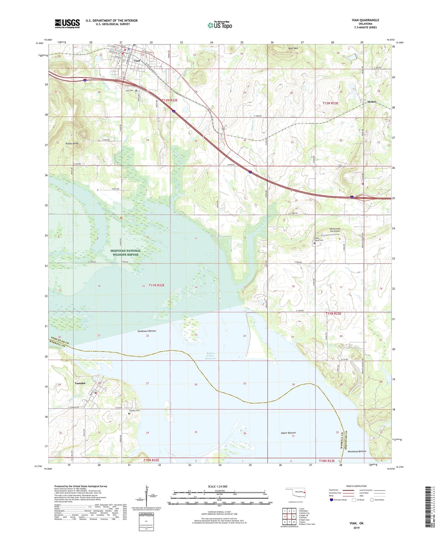
2022 topographic map quadrangle Vian in the state of Oklahoma. Scale: 1:24000. Based on the newly updated USGS 7.5' US Topo map series, this map is in the following counties: Sequoyah, Haskell. The map contains contour data, water features, and other items you are used to seeing on USGS maps, but also has updated roads and other features. This is the next generation of topographic maps. Printed on high-quality waterproof paper with UV fade-resistant inks.
Quads adjacent to this one:
West: Stigler NE
Northwest: Gore
North: Blackgum
Northeast: Marble City
East: Sallisaw
Southeast: Robert S Kerr Dam
South: Keota
Southwest: Stigler East
This map covers the same area as the classic USGS quad with code o35094d8.
Contains the following named places: Bethel Church, Bluff Church, Drakestand Cemetery, Little Vian Creek, McKey, McKey Rural Fire Association, Mount Olive Church, Negro Creek, Neversweat Too Airport, Pafford Emergency Medical Services Vian Substation, Pheasant Creek, Potato Knob, Sallisaw Creek Site 2 Dam, Sallisaw Creek Site 2 Reservoir, Sandtown Bottom, Saylor Bottom, Tamaha, Tamaha Cemetery, Tamaha Volunteer Fire Department, Township of Vian, Vian, Vian Creek, Vian Creek Public Use Area, Vian Elementary School, Vian Fire Department Station 1 Headquarters, Vian Fire Department Station 2, Vian High School, Vian Middle School, Vian Police Department, Vian Post Office, Vien Cemetery, Watts Church, Wolf Mountain