MyTopo
Russell Oklahoma US Topo Map
Couldn't load pickup availability
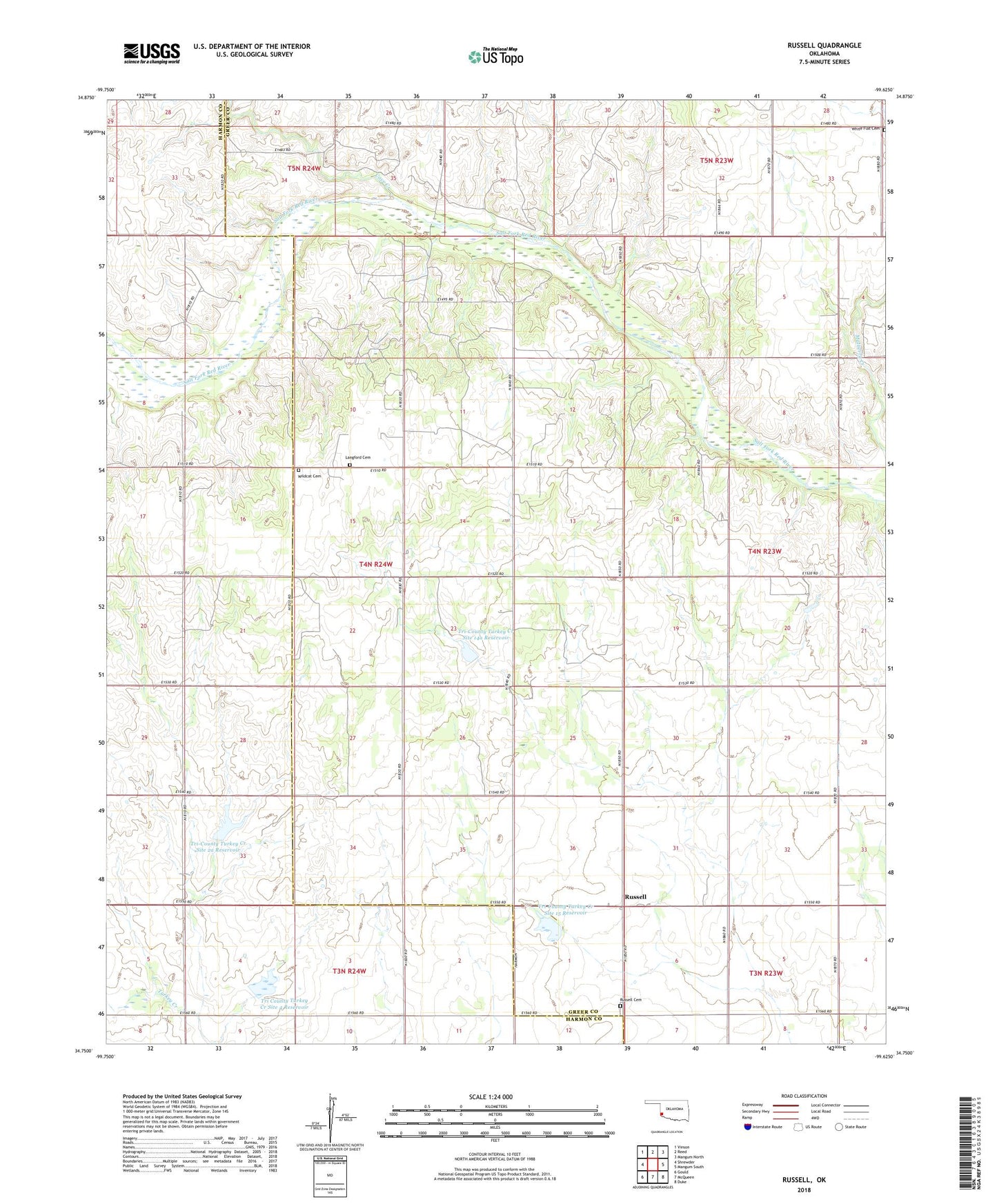
2022 topographic map quadrangle Russell in the state of Oklahoma. Scale: 1:24000. Based on the newly updated USGS 7.5' US Topo map series, this map is in the following counties: Greer, Harmon. The map contains contour data, water features, and other items you are used to seeing on USGS maps, but also has updated roads and other features. This is the next generation of topographic maps. Printed on high-quality waterproof paper with UV fade-resistant inks.
Quads adjacent to this one:
West: Shrewder
Northwest: Vinson
North: Reed
Northeast: Mangum North
East: Mangum South
Southeast: Duke
South: McQueen
Southwest: Gould
This map covers the same area as the classic USGS quad with code o34099g6.
Contains the following named places: Cave Creek, Langford Cemetery, Russell, Russell Cemetery, Tri County Turkey Creek Site 4 Reservoir, Tri-County Turkey Creek Site 14a Dam, Tri-County Turkey Creek Site 14a Reservoir, Tri-County Turkey Creek Site 15 Dam, Tri-County Turkey Creek Site 15 Reservoir, Tri-County Turkey Creek Site 2a Dam, Tri-County Turkey Creek Site 2a Reservoir, Tri-County Turkey Creek Site 4 Dam, White Flat Cemetery, Wildcat Cemetery