MyTopo
Henryetta SW Oklahoma US Topo Map
Couldn't load pickup availability
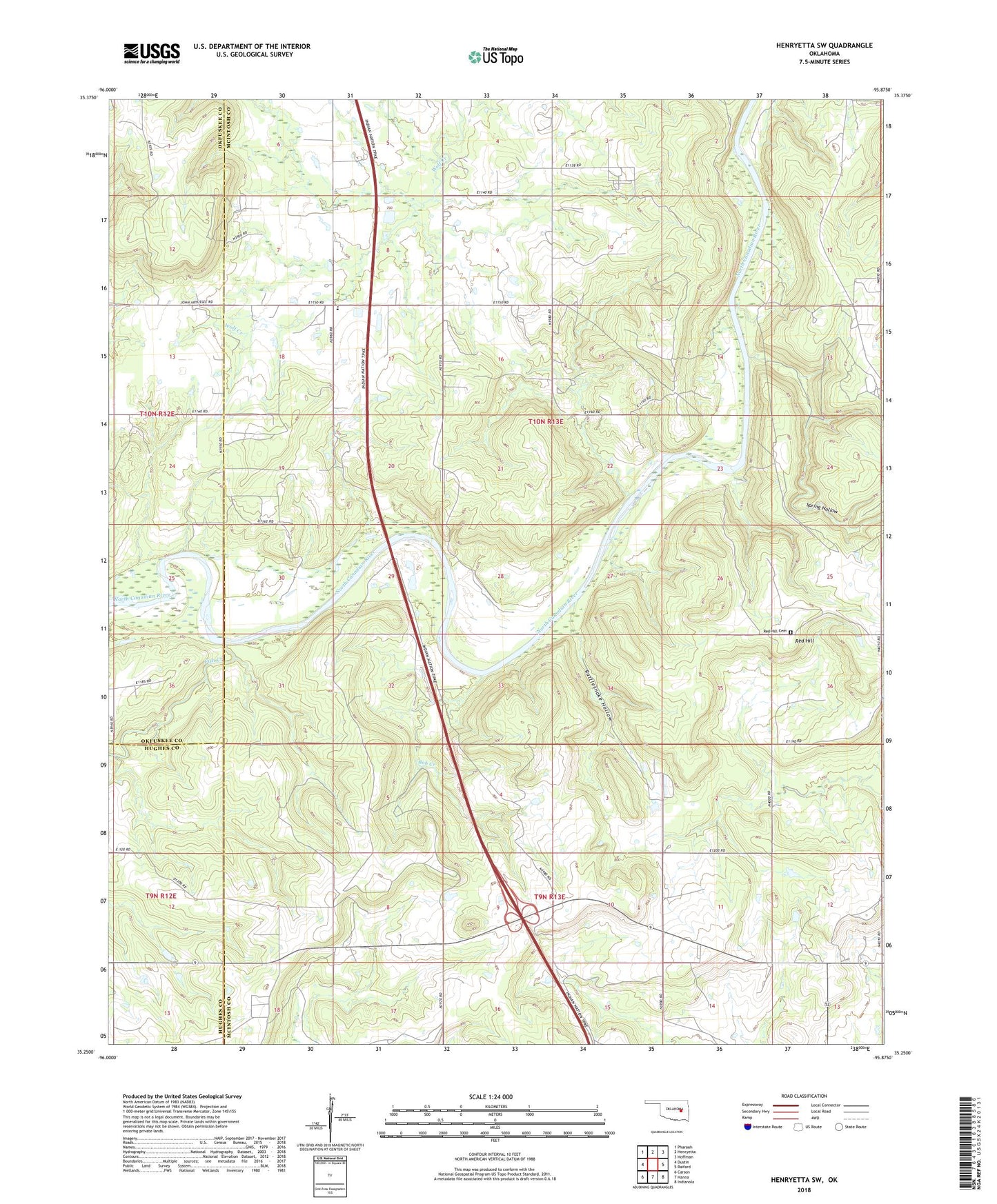
2018 topographic map quadrangle Henryetta SW in the state of Oklahoma. Scale: 1:24000. Based on the newly updated USGS 7.5' US Topo map series, this map is in the following counties: McIntosh, Okfuskee, Hughes. The map contains contour data, water features, and other items you are used to seeing on USGS maps, but also has updated roads and other features. This is the next generation of topographic maps. Printed on high-quality waterproof paper with UV fade-resistant inks.
Quads adjacent to this one:
West: Dustin
Northwest: Pharoah
North: Henryetta
Northeast: Hoffman
East: Raiford
Southeast: Indianola
South: Hanna
Southwest: Carson
Contains the following named places: Bob Creek, Fish Creek, Hanna Division, Hickory Ground Number 1 Church, Hickory Ground Number 2 Church, Hutche Chuppa Church, Rattlesnake Hollow, Red Hill, Red Hill Cemetery, Ryal Elementary School, Spring Hollow, Stidham Creek, Township of Ryals, Yardeka Church, Yardeka School