MyTopo
Raiford Oklahoma US Topo Map
Couldn't load pickup availability
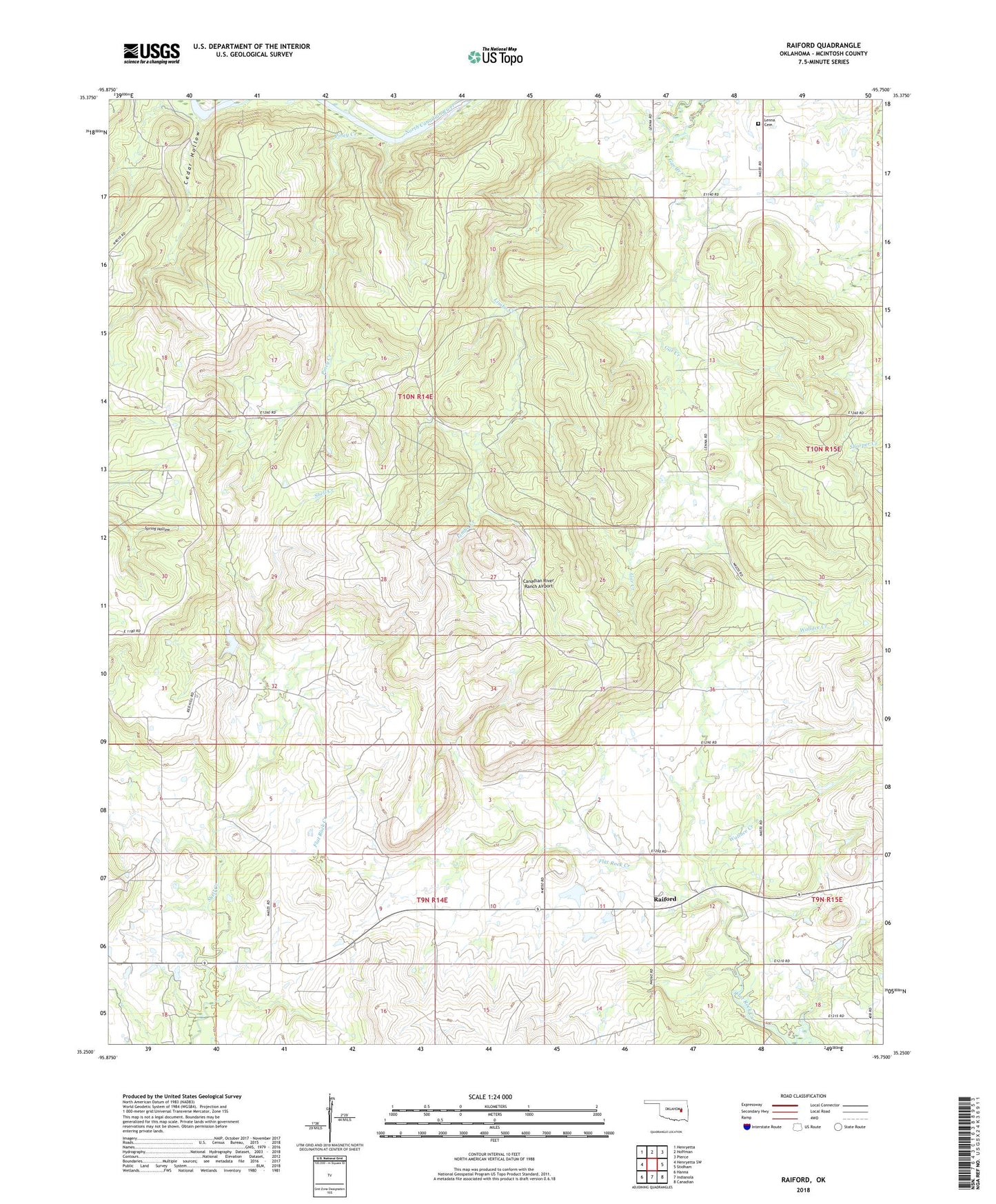
2022 topographic map quadrangle Raiford in the state of Oklahoma. Scale: 1:24000. Based on the newly updated USGS 7.5' US Topo map series, this map is in the following counties: McIntosh. The map contains contour data, water features, and other items you are used to seeing on USGS maps, but also has updated roads and other features. This is the next generation of topographic maps. Printed on high-quality waterproof paper with UV fade-resistant inks.
Quads adjacent to this one:
West: Henryetta SW
Northwest: Henryetta
North: Hoffman
Northeast: Pierce
East: Stidham
Southeast: Canadian
South: Indianola
Southwest: Hanna
This map covers the same area as the classic USGS quad with code o35095c7.
Contains the following named places: Canadian River Ranch Airport, Cedar Hollow, Lenna Cemetery, Lenna School, Oknoname 131016 Dam, Oknoname 131016 Reservoir, Piney Creek, Raiford, Wallace Creek