MyTopo
Hoffman Oklahoma US Topo Map
Couldn't load pickup availability
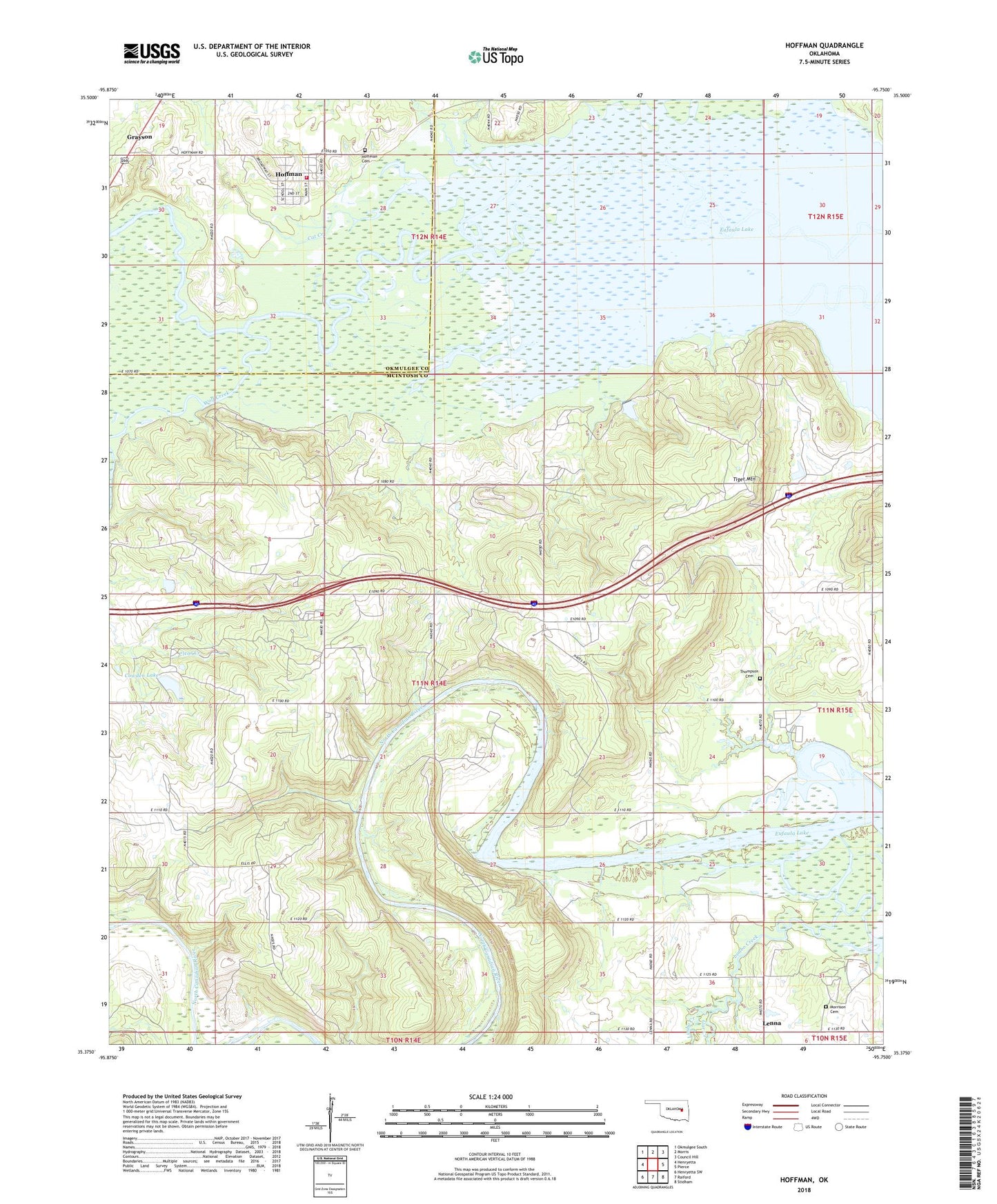
2022 topographic map quadrangle Hoffman in the state of Oklahoma. Scale: 1:24000. Based on the newly updated USGS 7.5' US Topo map series, this map is in the following counties: McIntosh, Okmulgee. The map contains contour data, water features, and other items you are used to seeing on USGS maps, but also has updated roads and other features. This is the next generation of topographic maps. Printed on high-quality waterproof paper with UV fade-resistant inks.
Quads adjacent to this one:
West: Henryetta
Northwest: Okmulgee South
North: Morris
Northeast: Council Hill
East: Pierce
Southeast: Stidham
South: Raiford
Southwest: Henryetta SW
This map covers the same area as the classic USGS quad with code o35095d7.
Contains the following named places: Burney, Cat Creek, Cowden Lake, Cowden Lake Dam, Eufaula Wildlife Managment Area, Gar Creek, Grave Creek, Hilltop School, Hoffman, Hoffman Cemetery, Hoffman Volunteer Fire Department, Lenna, Lenna Post Office, Limbo Creek, Little Coweta Church, Morrison Cemetery, Sallisaw Park Lake, Sallisaw Park Lake Dam, Silver Spring Church, Thompson Cemetery, Tiger Mountain, Tiger Mountain Rural Fire Department, Tiger Mountain School, Town of Hoffman, Township of McDaniels, Wolf Creek