MyTopo
Hollister NW Oklahoma US Topo Map
Couldn't load pickup availability
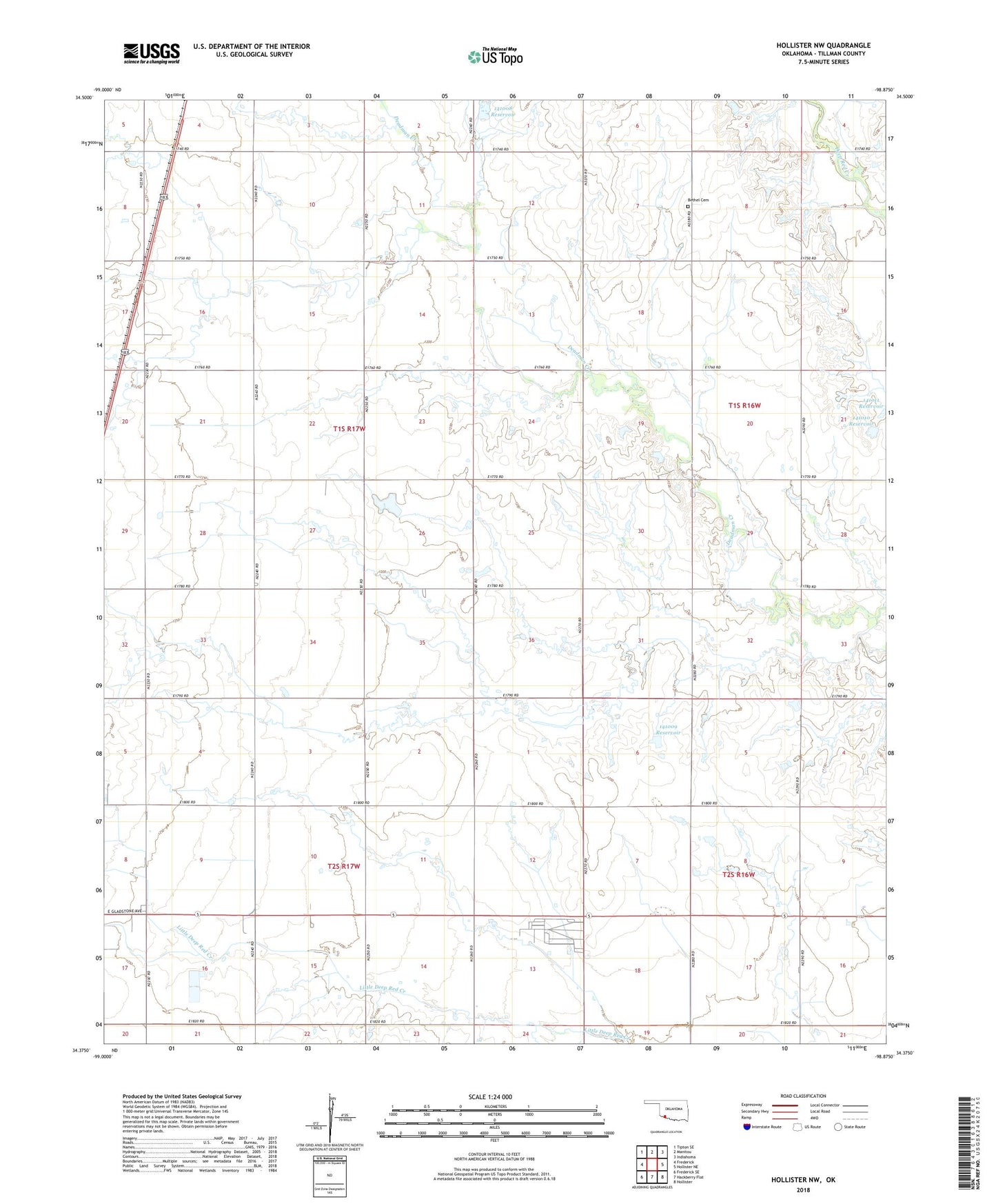
2018 topographic map quadrangle Hollister NW in the state of Oklahoma. Scale: 1:24000. Based on the newly updated USGS 7.5' US Topo map series, this map is in the following counties: Tillman. The map contains contour data, water features, and other items you are used to seeing on USGS maps, but also has updated roads and other features. This is the next generation of topographic maps. Printed on high-quality waterproof paper with UV fade-resistant inks.
Quads adjacent to this one:
West: Frederick
Northwest: Tipton SE
North: Manitou
Northeast: Indiahoma
East: Hollister NE
Southeast: Hollister
South: Hackberry Flat
Southwest: Frederick SE
Contains the following named places: Bethel Cemetery, Frederick Division, Oknoname 141008 Dam, Oknoname 141008 Reservoir, Oknoname 141009 Dam, Oknoname 141009 Reservoir, Oknoname 141010 Dam, Oknoname 141010 Reservoir, Oknoname 141011 Dam, Oknoname 141011 Reservoir, ZIP Code: 73542