MyTopo
Manitou Oklahoma US Topo Map
Couldn't load pickup availability
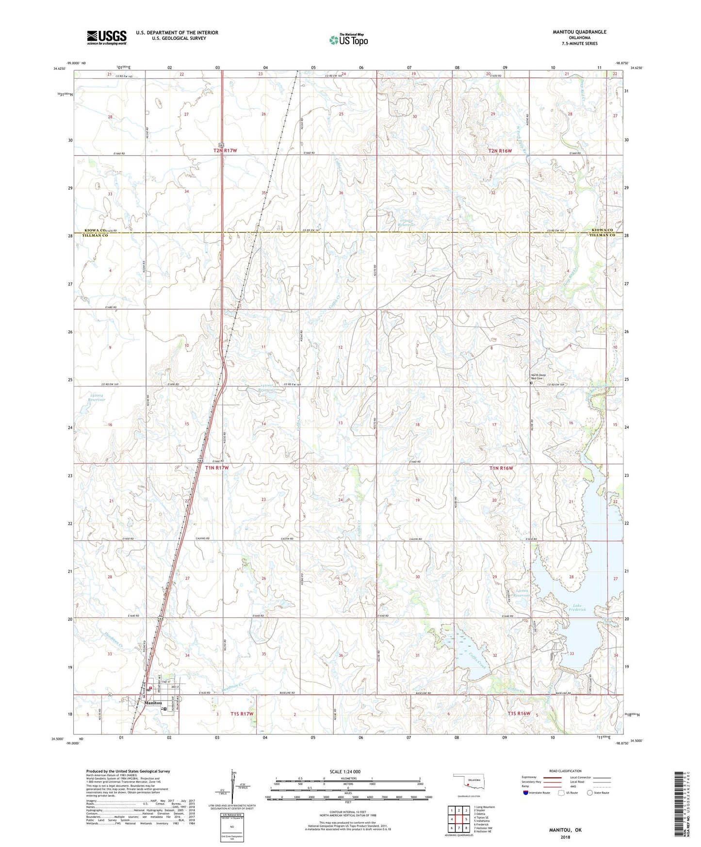
2022 topographic map quadrangle Manitou in the state of Oklahoma. Scale: 1:24000. Based on the newly updated USGS 7.5' US Topo map series, this map is in the following counties: Tillman, Kiowa. The map contains contour data, water features, and other items you are used to seeing on USGS maps, but also has updated roads and other features. This is the next generation of topographic maps. Printed on high-quality waterproof paper with UV fade-resistant inks.
Quads adjacent to this one:
West: Tipton SE
Northwest: Long Mountain
North: Snyder
Northeast: Odetta
East: Indiahoma
Southeast: Hollister NE
South: Hollister NW
Southwest: Frederick
This map covers the same area as the classic USGS quad with code o34098e8.
Contains the following named places: Coffin Creek, Curtis Cove, Deep Red Run-Coffin Creek Site 1 Dam, Deep Red Run-Coffin Creek Site 1 Reservoir, Deep Red Run-Coffin Creek Site 2 Dam, Deep Red Run-Coffin Creek Site 2 Reservoir, Lake Frederick, Manitou, Manitou Post Office, Manitou Volunteer Fire Department, North Deep Red Cemetery, Oknoname 075012 Dam, Oknoname 075012 Reservoir, Oknoname 141004 Dam, Oknoname 141004 Reservoir, Oknoname 141005 Dam, Oknoname 141005 Reservoir, Oknoname 141007 Dam, Oknoname 141007 Reservoir, Oknoname 141019 Dam, Oknoname 141019 Reservoir, Southwest Oklahoma Juvenile Center, Taylor, Town of Manitou, Township of Hunter, West Fork Deep Red Creek, ZIP Codes: 73555, 73566