MyTopo
Tipton SE Oklahoma US Topo Map
Couldn't load pickup availability
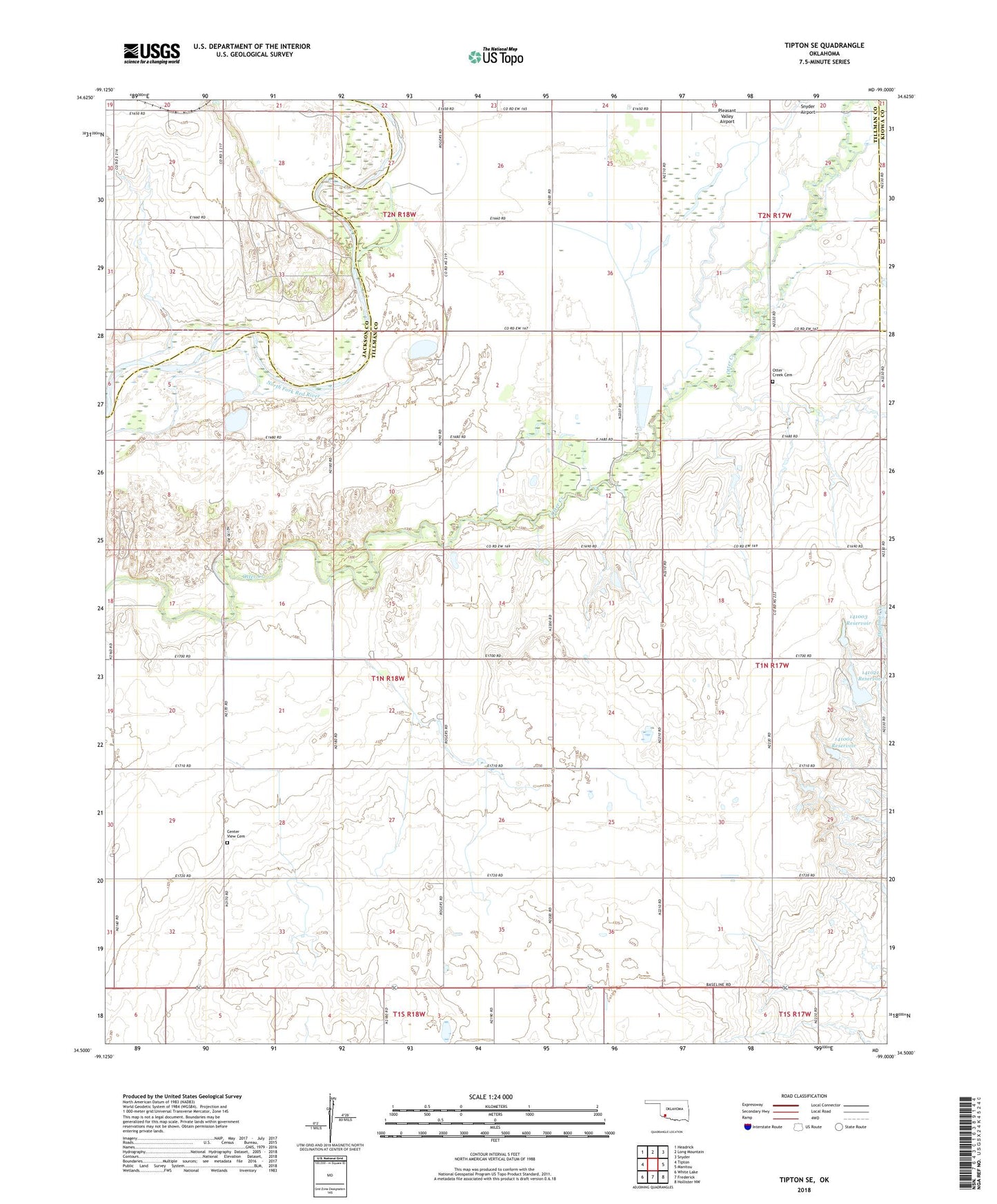
2022 topographic map quadrangle Tipton SE in the state of Oklahoma. Scale: 1:24000. Based on the newly updated USGS 7.5' US Topo map series, this map is in the following counties: Tillman, Jackson, Kiowa. The map contains contour data, water features, and other items you are used to seeing on USGS maps, but also has updated roads and other features. This is the next generation of topographic maps. Printed on high-quality waterproof paper with UV fade-resistant inks.
Quads adjacent to this one:
West: Tipton
Northwest: Headrick
North: Long Mountain
Northeast: Snyder
East: Manitou
Southeast: Hollister NW
South: Frederick
Southwest: White Lake
This map covers the same area as the classic USGS quad with code o34099e1.
Contains the following named places: Center View Cemetery, Mount Gillian Church, Oknoname 141002 Dam, Oknoname 141002 Reservoir, Oknoname 141003 Dam, Oknoname 141003 Reservoir, Oknoname 141021 Dam, Oknoname 141021 Reservoir, Otter Creek Cemetery, Otter Creek Church, Pleasant Valley Airport, Pleasant Valley Church, Pleasant Valley Community Hall, Tipton Division, ZIP Code: 73570