MyTopo
Indiahoma Oklahoma US Topo Map
Couldn't load pickup availability
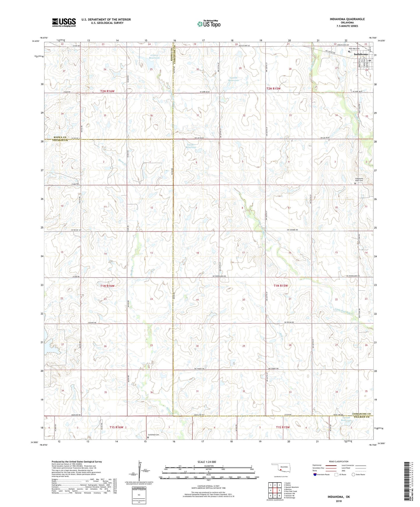
2022 topographic map quadrangle Indiahoma in the state of Oklahoma. Scale: 1:24000. Based on the newly updated USGS 7.5' US Topo map series, this map is in the following counties: Comanche, Tillman, Kiowa. The map contains contour data, water features, and other items you are used to seeing on USGS maps, but also has updated roads and other features. This is the next generation of topographic maps. Printed on high-quality waterproof paper with UV fade-resistant inks.
Quads adjacent to this one:
West: Manitou
Northwest: Snyder
North: Odetta
Northeast: Quanah Mountain
East: Post Oak Creek
Southeast: Chattanooga
South: Hollister NE
Southwest: Hollister NW
This map covers the same area as the classic USGS quad with code o34098e7.
Contains the following named places: First Baptist Church, Indiahoma, Indiahoma Elementary School, Indiahoma High School, Indiahoma IOOF Cemetery, Indiahoma Post Office, North Deep Red Church, Oknoname 031066 Dam, Oknoname 031066 Reservoir, Oknoname 031067 Dam, Oknoname 031067 Reservoir, Oknoname 075013 Dam, Oknoname 075013 Reservoir, Oknoname 141006 Dam, Oknoname 141006 Reservoir, Peace Congregational Church, Pilgrim Church, Post Oak Cemetery, Post Oak Church, Post Oak Mission School, Prairie View Church, Schofield Cemetery, Town of Indiahoma, Township of Indiahoma