MyTopo
Hydro Oklahoma US Topo Map
Couldn't load pickup availability
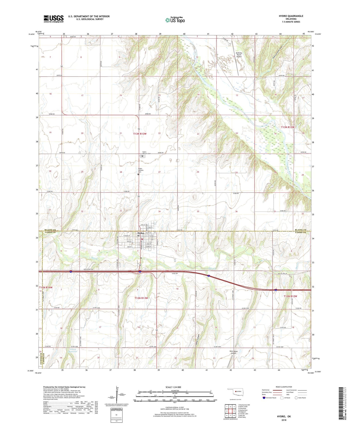
2018 topographic map quadrangle Hydro in the state of Oklahoma. Scale: 1:24000. Based on the newly updated USGS 7.5' US Topo map series, this map is in the following counties: Blaine, Caddo, Custer. The map contains contour data, water features, and other items you are used to seeing on USGS maps, but also has updated roads and other features. This is the next generation of topographic maps. Printed on high-quality waterproof paper with UV fade-resistant inks.
Quads adjacent to this one:
West: Weatherford
Northwest: Weatherford NW
North: Squaw Creek
Northeast: Greenfield
East: Bridgeport
Southeast: Rock Mary
South: Eakly NE
Southwest: Crowder Lake
Contains the following named places: American Horse Canyon, Baptist Church, Cedar Canyon, Dead Woman Creek, Entz Home Airport, Hydro, Hydro - Eakly Elementary School, Hydro - Eakly High School, Hydro - Eakly Middle School, Hydro Catholic Cemetery, Hydro Masonic Cemetery, Hydro Police Department, Hydro Post Office, Hydro Volunteer Fire Department, Kits Airport, Lawles Airport, McCool, McKinley Ranch Airport, Oknoname 015015 Dam, Oknoname 015015 Reservoir, Town of Hydro, Township of Hydro, Township of Long, United Methodist Church