MyTopo
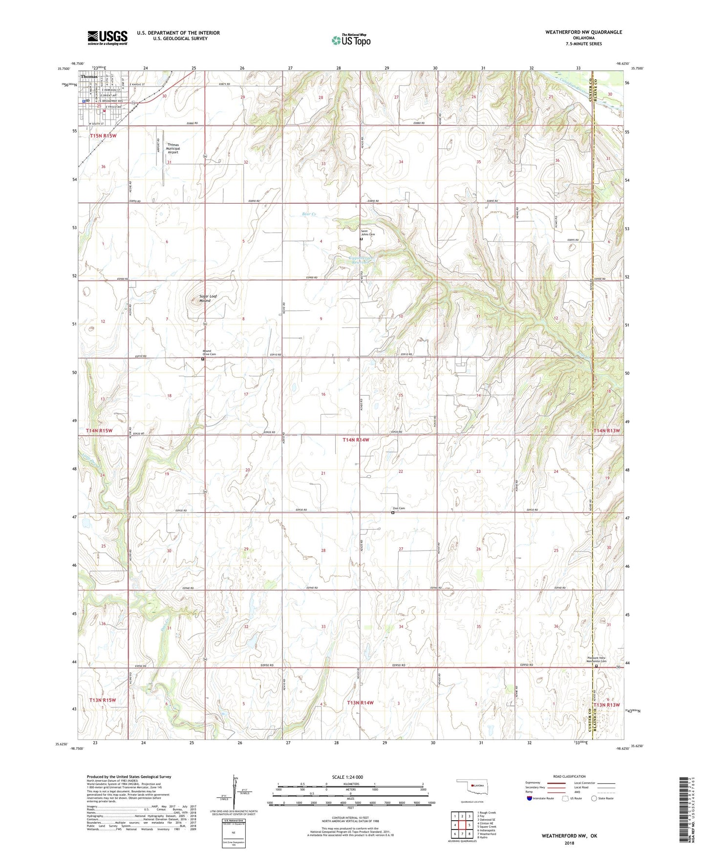
Weatherford NW Oklahoma US Topo Map
Couldn't load pickup availability
2022 topographic map quadrangle Weatherford NW in the state of Oklahoma. Scale: 1:24000. Based on the newly updated USGS 7.5' US Topo map series, this map is in the following counties: Custer, Blaine. The map contains contour data, water features, and other items you are used to seeing on USGS maps, but also has updated roads and other features. This is the next generation of topographic maps. Printed on high-quality waterproof paper with UV fade-resistant inks.
Quads adjacent to this one:
West: Clinton NE
Northwest: Rough Creek
North: Fay
Northeast: Oakwood SE
East: Squaw Creek
Southeast: Hydro
South: Weatherford
Southwest: Indianapolis
This map covers the same area as the classic USGS quad with code o35098f6.
Contains the following named places: City of Thomas, Hutchinson Landing Strip, Indian Mission Church, Jefferson School, Kippinberger Dam, Kippinberger Reservoir, Little Deer Creek, Mound Olive Cemetery, Mulberry School, Perkins Airport, Pleasant View Mennonite Cemetery, Pleasant View Mennonite Church, R Wickham Number 2 Dam, R Wickham Number 2 Reservoir, Saint Johns Cemetery, Sallisaw Creek Site 16 Dam, Sallisaw Creek Site 16 Reservoir, Sinor Emergency Medical Services Thomas, Sugar Loaf Mound, Thomas, Thomas Division, Thomas Municipal Airport, Thomas Police Department, Thomas Post Office, Thomas Volunteer Fire Department, Township of Deer Creek, Zion Cemetery, Zion Church, ZIP Code: 73669