MyTopo
Squaw Creek Oklahoma US Topo Map
Couldn't load pickup availability
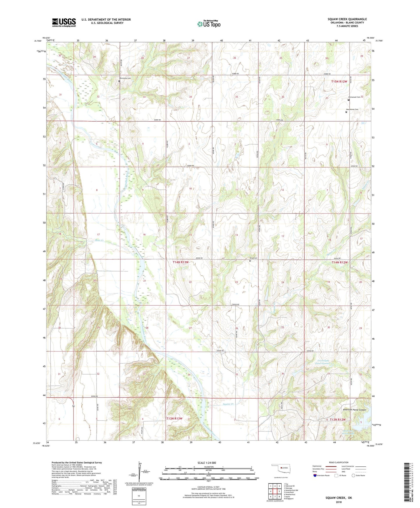
2023 topographic map quadrangle Squaw Creek in the state of Oklahoma. Scale: 1:24000. Based on the newly updated USGS 7.5' US Topo map series, this map is in the following counties: Blaine. The map contains contour data, water features, and other items you are used to seeing on USGS maps, but also has updated roads and other features. This is the next generation of topographic maps. Printed on high-quality waterproof paper with UV fade-resistant inks.
Quads adjacent to this one:
West: Weatherford NW
Northwest: Fay
North: Oakwood SE
Northeast: Watonga
East: Greenfield
Southeast: Bridgeport
South: Hydro
Southwest: Weatherford
This map covers the same area as the classic USGS quad with code o35098f5.
Contains the following named places: American Horse Lake, American Horse Lake Dam, American Horse Lake State Hunting and Fishing Area, Bear Creek, Emmanuel Cemetery, Etna Cemetery, Etna Church, Groendyke Pond Number 1, Groendyke Pond Number 1 Dam, Macedonia Cemetery, Nelson Burns Dam, Nelson Burns Reservoir, Squaw Creek, Township of Logan, Whirlwind Cemetery