MyTopo
Kemp Oklahoma US Topo Map
Couldn't load pickup availability
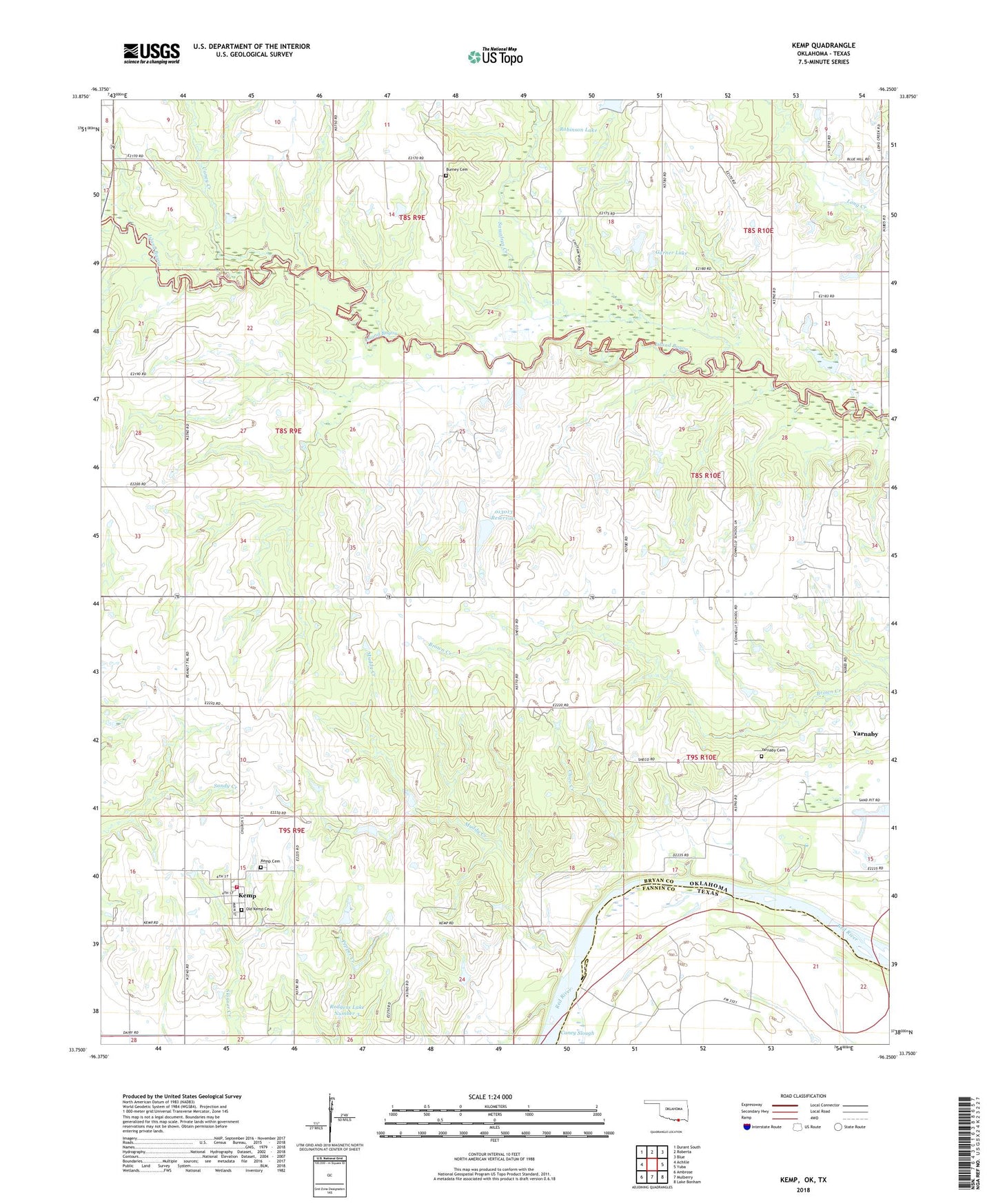
2018 topographic map quadrangle Kemp in the state of Oklahoma. Scale: 1:24000. Based on the newly updated USGS 7.5' US Topo map series, this map is in the following counties: Bryan, Fannin. The map contains contour data, water features, and other items you are used to seeing on USGS maps, but also has updated roads and other features. This is the next generation of topographic maps. Printed on high-quality waterproof paper with UV fade-resistant inks.
Quads adjacent to this one:
West: Achille
Northwest: Durant South
North: Roberta
Northeast: Blue
East: Yuba
Southeast: Lake Bonham
South: Mulberry
Southwest: Ambrose
Contains the following named places: Burney Cemetery, Caney Creek, Chico Creek, Cypress School, Garner Lake, Garner Lake Dam, Kemp, Kemp Cemetery, Kemp Fire Department, Muddy Creek, Oknoname 013013 Dam, Oknoname 013013 Reservoir, Oknoname 013014 Dam, Oknoname 013014 Reservoir, Old Kemp Cemetery, Prairie View Church, Robinson Lake, Robinson Lake Dam, Rodgers Lake Number 3, Rodgers Lake Number 3 Dam, Sassafras Creek, South Bryan Division, Town of Kemp, Township of Kemp, Yarnaby, Yarnaby Cemetery, ZIP Codes: 74720, 74741, 74747