MyTopo
Blue Oklahoma US Topo Map
Couldn't load pickup availability
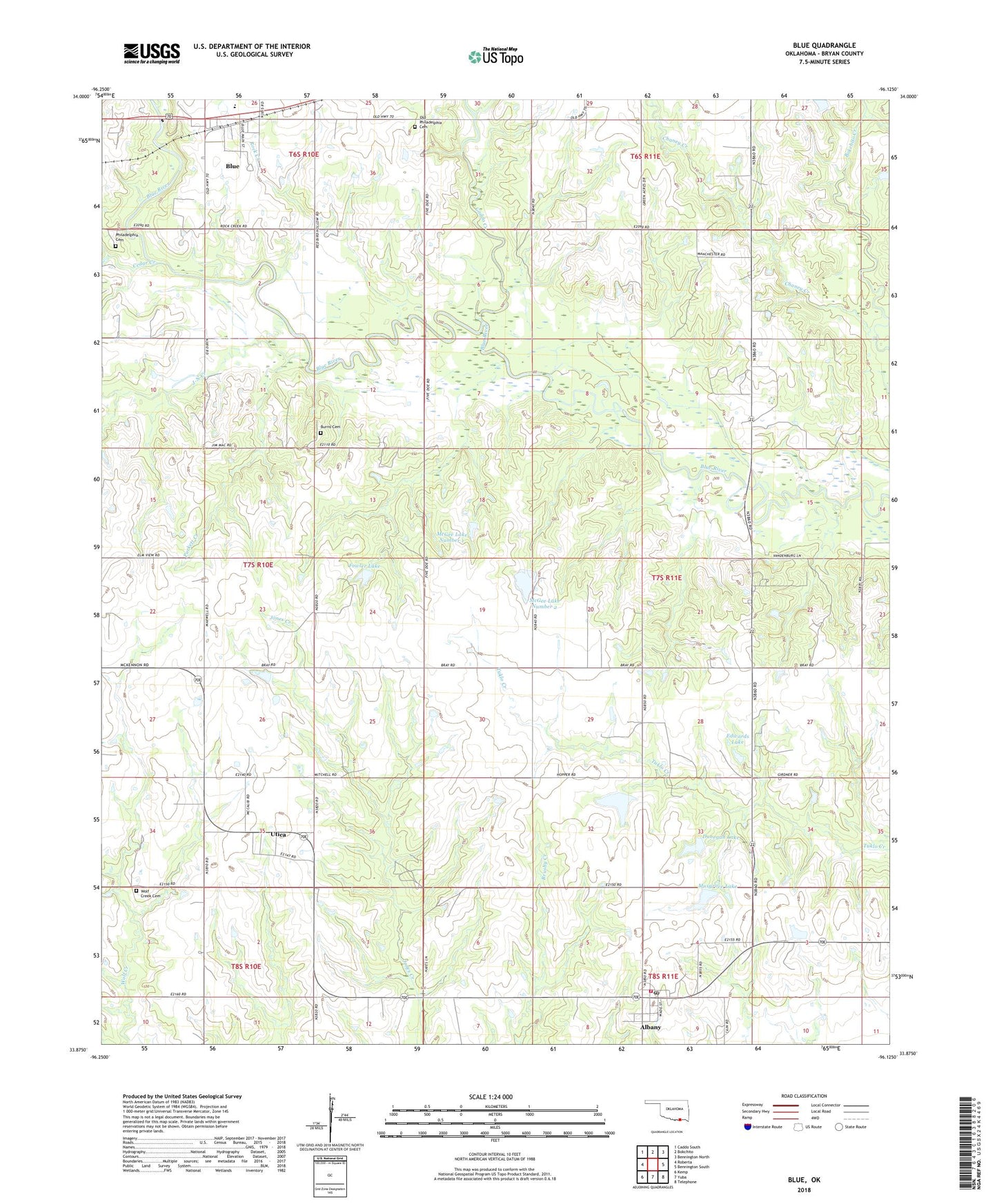
2022 topographic map quadrangle Blue in the state of Oklahoma. Scale: 1:24000. Based on the newly updated USGS 7.5' US Topo map series, this map is in the following counties: Bryan. The map contains contour data, water features, and other items you are used to seeing on USGS maps, but also has updated roads and other features. This is the next generation of topographic maps. Printed on high-quality waterproof paper with UV fade-resistant inks.
Quads adjacent to this one:
West: Roberta
Northwest: Caddo South
North: Bokchito
Northeast: Bennington North
East: Bennington South
Southeast: Telephone
South: Yuba
Southwest: Kemp
This map covers the same area as the classic USGS quad with code o33096h2.
Contains the following named places: Albany, Albany Census Designated Place, Albany Fire Department, Albany Post Office, Blue, Blue Census Designated Place, Bray-Maxwell School, Burris Cemetery, Caddo Creek, Cedar Creek, Chaney Creek, County District 9, Dunegan Lake, Dunegan Lake Dam, Edwards Lake, Edwards Lake Dam, Fowler Lake, Fowler Lake Dam, J-N Creek, McGee Lake Number 1, McGee Lake Number 1 Dam, McGee Lake Number 2, McGee Lake Number 2 Dam, Musgrove Lake, Musgrove Lake Dam, Old Philadelphia Cemetery, Philadelphia Cemetery, Puckett Creek, Rock Branch, Rock Creek, Rock Creek Elementary School, Texoma Speedway, Utica, Utica Census Designated Place, Wolf Creek Cemetery, ZIP Code: 74726