MyTopo
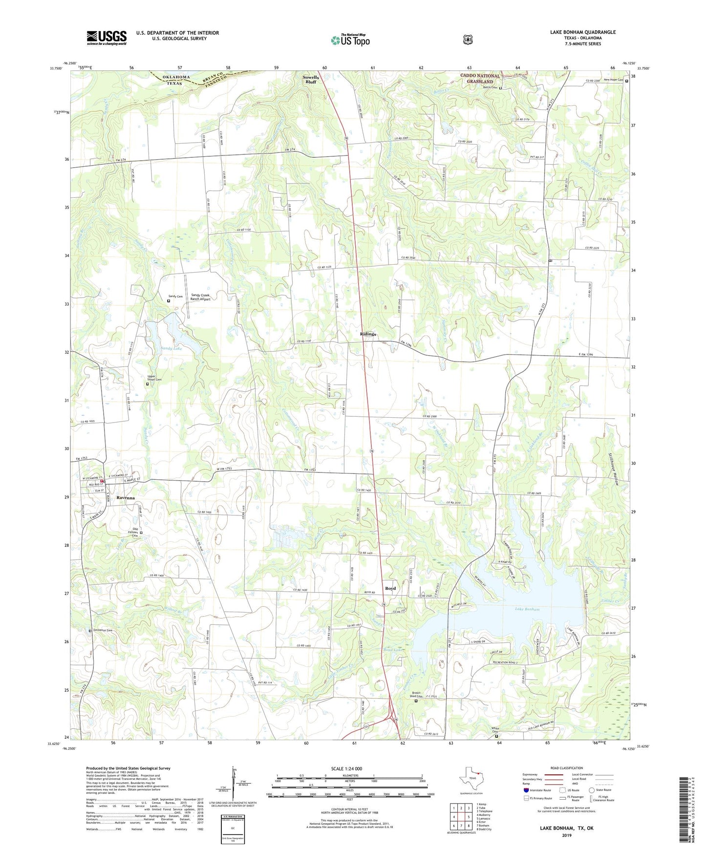
Lake Bonham Texas US Topo Map
Couldn't load pickup availability
Also explore the Lake Bonham Forest Service Topo of this same quad for updated USFS data
2022 topographic map quadrangle Lake Bonham in the state of Texas. Scale: 1:24000. Based on the newly updated USGS 7.5' US Topo map series, this map is in the following counties: Fannin, Bryan. The map contains contour data, water features, and other items you are used to seeing on USGS maps, but also has updated roads and other features. This is the next generation of topographic maps. Printed on high-quality waterproof paper with UV fade-resistant inks.
Quads adjacent to this one:
West: Mulberry
Northwest: Kemp
North: Yuba
Northeast: Telephone
East: Lamasco
Southeast: Dodd City
South: Bonham
Southwest: Ector
This map covers the same area as the classic USGS quad with code o33096f2.
Contains the following named places: Anthony Branch, Bettes Cemetery, Bettis, Bettis Creek, Boyd, Boyd Lake, Brown Cemetery, Brue - Rostine Cemetery, City of Ravenna, Corrigan Lake Number 1, Corrigan Lake Number 1 Dam, Corrigan Lake Number 2, Corrigan Lake Number 2 Dam, East Oakland Branch, Eminence Cemetery, Finley, Ivanhoe, Ivanhoe Post Office, Lake Bonham, Lake Bonham Dam, Lake Bonham Park, Lake Bonham Recreation Area, Little Timber Creek, Macedoniaqchurch, New Hope Cemetery, New Union Cemetery, Oakland, Odd Fellows Cemetery, Pioneer Grave Yard, Ravenna, Ravenna City Hall, Ravenna Post Office, Ravenna Volunteer Fire Department, Ridings, Sand Creek, Sandy Cemetery, Sandy Church, Sandy Creek Ranch Airport, Sandy Lake, Stillhouse Branch, Stillhouse Hollow, Union Church, Upper Union Cemetery, West Oakland Branch, White Cemetery, White Shed, Wolf Creek, ZIP Code: 75476