MyTopo
Mulberry Texas US Topo Map
Couldn't load pickup availability
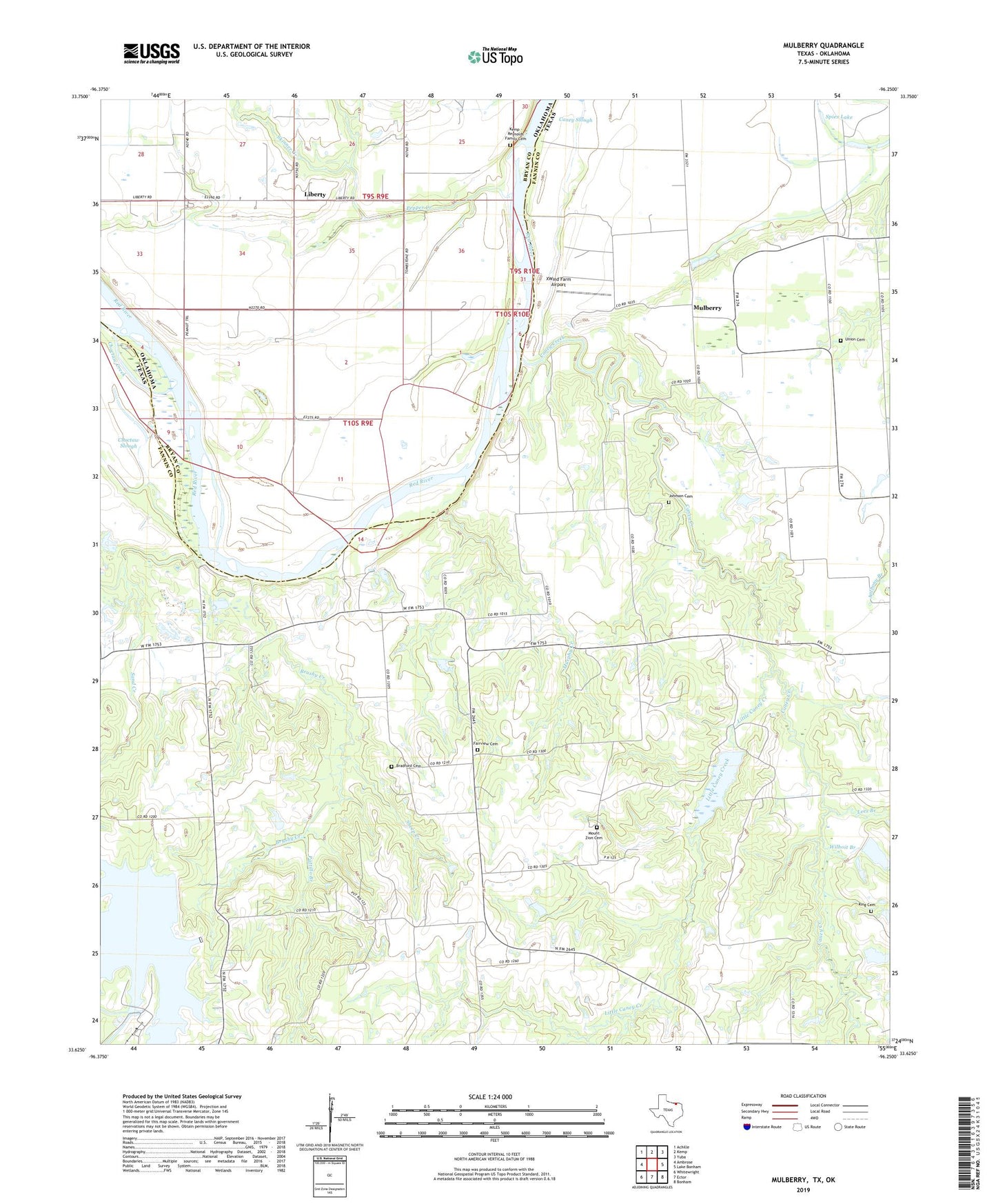
2022 topographic map quadrangle Mulberry in the states of Texas, Oklahoma. Scale: 1:24000. Based on the newly updated USGS 7.5' US Topo map series, this map is in the following counties: Fannin, Bryan. The map contains contour data, water features, and other items you are used to seeing on USGS maps, but also has updated roads and other features. This is the next generation of topographic maps. Printed on high-quality waterproof paper with UV fade-resistant inks.
Quads adjacent to this one:
West: Ambrose
Northwest: Achille
North: Kemp
Northeast: Yuba
East: Lake Bonham
Southeast: Bonham
South: Ector
Southwest: Whitewright
This map covers the same area as the classic USGS quad with code o33096f3.
Contains the following named places: Anthony, Bell - Youree Cemetery, Bradford Cemetery, Brushy Creek, Caney Creek, Caney Slough, Carpenter Lake, Carpenter Lake Dam, Choctaw Creek, Choctaw Slough, Fairview Cemetery, Johnson Cemetery, Kemp - Reynolds Family Cemetery, King Cemetery, Klose Lake, Klose Lake Dam, Lees Branch, Liberty, Little Caney Creek, Mount Zion Cemetery, Mulberry, Mulberry Cemetery, Mulberry Church, Murphy Creek, Parker Grove Church, Pattillo Branch, Pecan Grove Church, Pepper Creek, Sand Creek, Sheep Creek, Skinner Creek, Soil Conservation Service Site 13 Dam, Soil Conservation Service Site 13 Reservoir, Soil Conservation Service Site 14 Dam, Soil Conservation Service Site 14 Reservoir, Soil Conservation Service Site 15 Dam, Soil Conservation Service Site 15 Reservoir, Spies Lake, Texas No Name Number 31 Dam, Union Cemetery, Valley Lake, Valley Lake Dam, Valley of Peace Cemetery, Virginia Point Church, Wilhoit Branch, XWind Farm Airport