MyTopo
Kenton NE Oklahoma US Topo Map
Couldn't load pickup availability
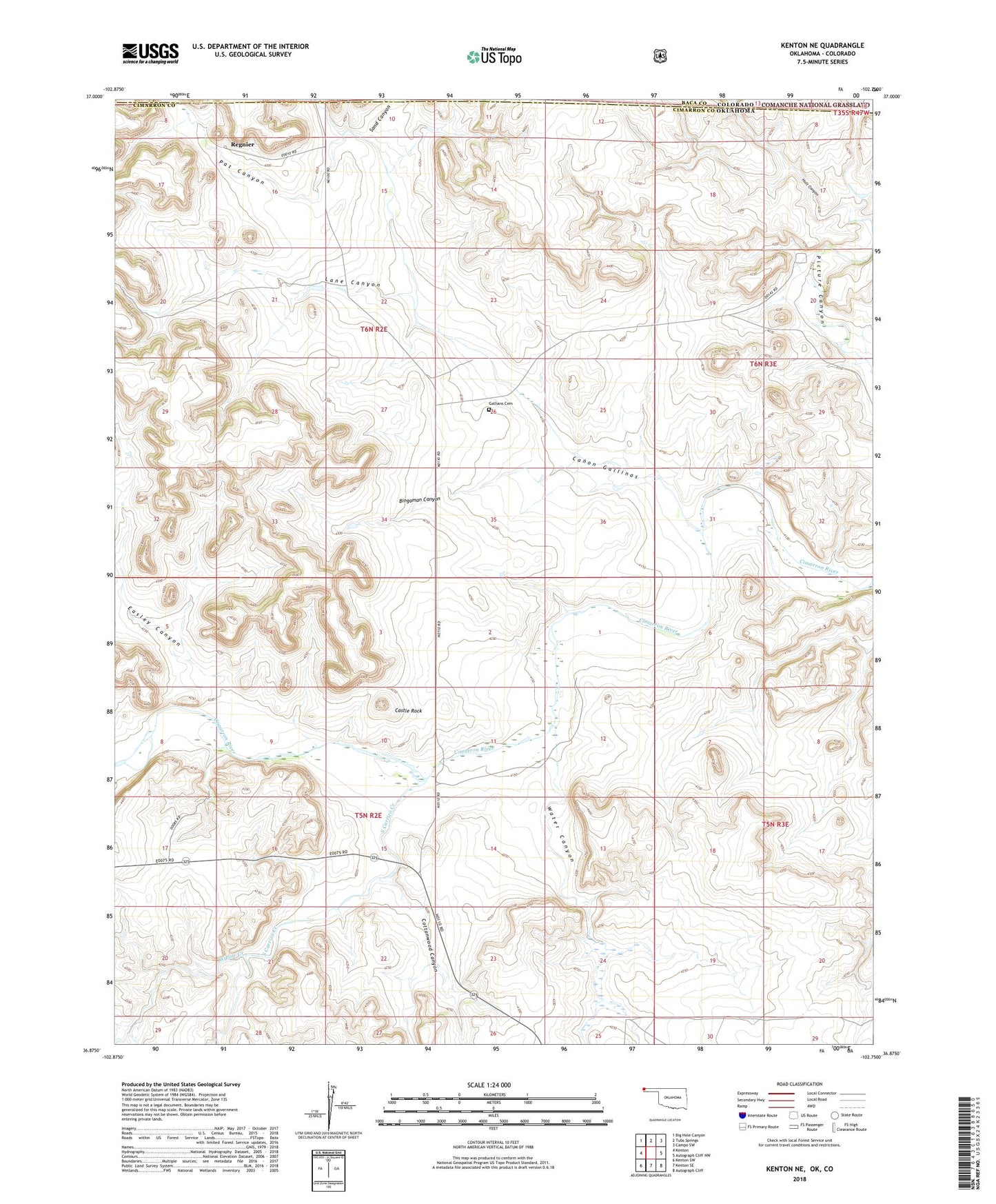
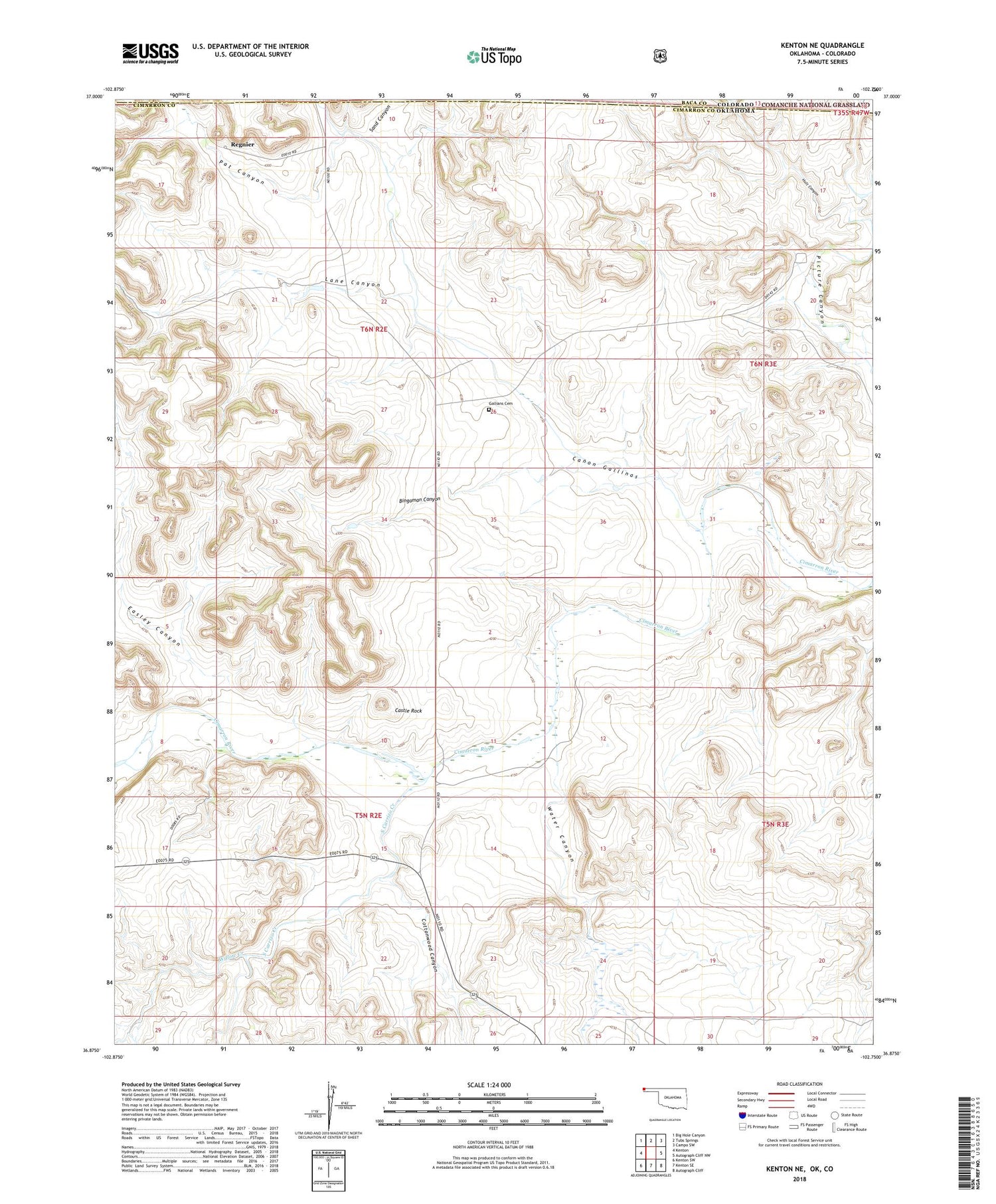
2018 topographic map quadrangle Kenton NE in the state of Oklahoma. Scale: 1:24000. Based on the newly updated USGS 7.5' US Topo map series, this map is in the following counties: Cimarron, Baca. The map contains contour data, water features, and other items you are used to seeing on USGS maps, but also has updated roads and other features. This is the next generation of topographic maps. Printed on high-quality waterproof paper with UV fade-resistant inks.
Quads adjacent to this one:
West: Kenton
Northwest: Big Hole Canyon
North: Tubs Springs
Northeast: Campo SW
East: Autograph Cliff NW
Southeast: Autograph Cliff
South: Kenton SE
Southwest: Kenton SW
Contains the following named places: Bingaman Canyon, Canon Gallinas, Castle Rock, Cottonwood Canyon, Easley Canyon, Gallians Cemetery, Holt Canyon, Lane Canyon, Pat Canyon, Regnier, Sand Canyon, South Carrizo Creek, Township of Kenton, Water Canyon, Willow Creek, ZIP Code: 73946