
MyTopo
Kingston South Oklahoma US Topo Map
Couldn't load pickup availability
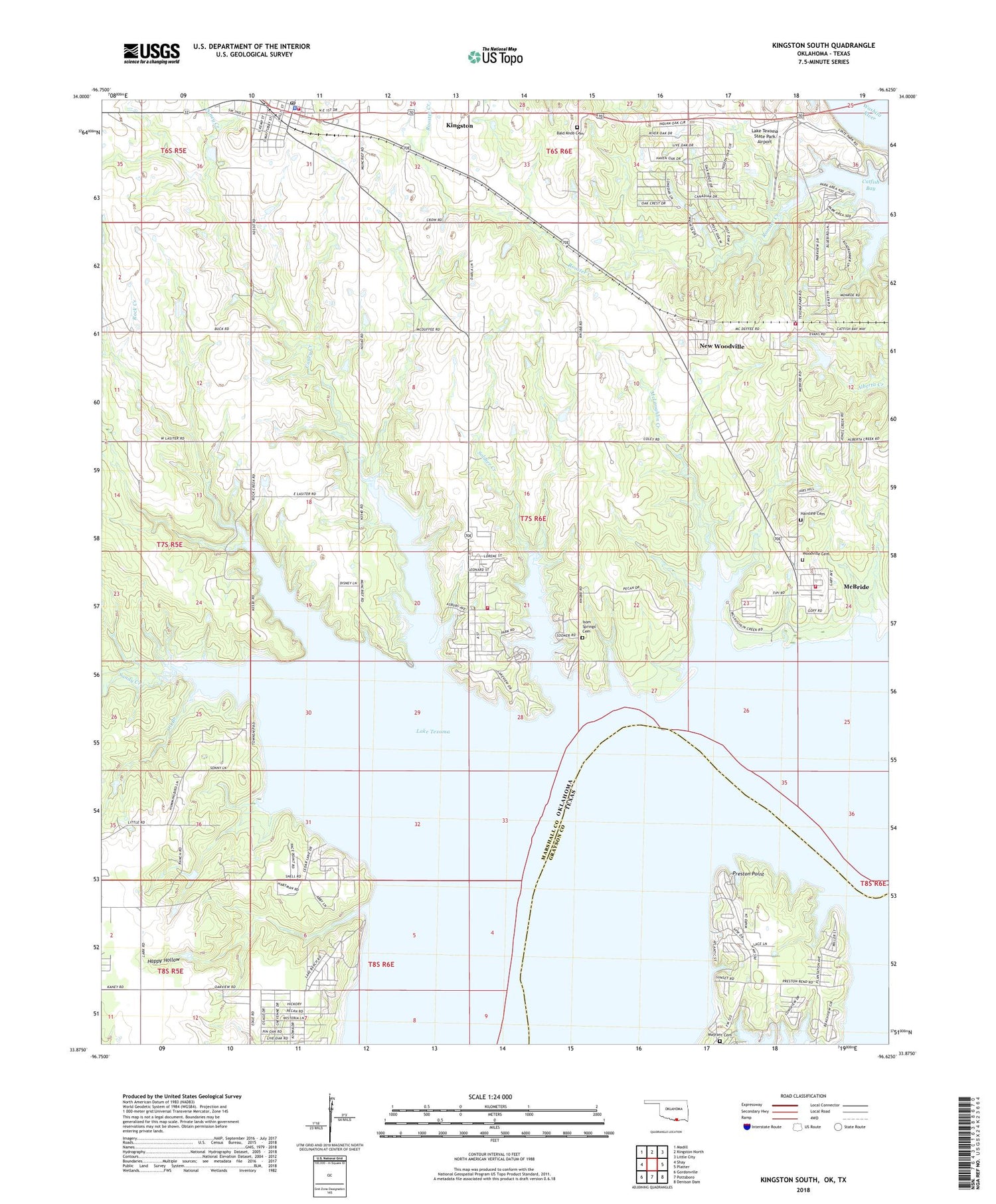
2018 topographic map quadrangle Kingston South in the states of Oklahoma, Texas. Scale: 1:24000. Based on the newly updated USGS 7.5' US Topo map series, this map is in the following counties: Marshall, Grayson. The map contains contour data, water features, and other items you are used to seeing on USGS maps, but also has updated roads and other features. This is the next generation of topographic maps. Printed on high-quality waterproof paper with UV fade-resistant inks.
Quads adjacent to this one:
West: Shay
Northwest: Madill
North: Kingston North
Northeast: Little City
East: Platter
Southeast: Denison Dam
South: Pottsboro
Southwest: Gordonville
Contains the following named places: Bald Knob Cemetery, Caney - Soldier Fire Department, Caney Creek, Caney Creek Airport, Caney Creek Public Use Area, Catfish Bay, Glen Eden, Hainline Cemetery, Happy Hollow, Isom Springs Cemetery, Isom Springs Oil Field, Kingston, Kingston Fire Department, Kingston Police Department, Kingston Post Office, Lake School, Lake Texoma, Lake Texoma State Park, Lake Texoma State Park Airport, Mayrant Cemetery, McBride, McBride Census Designated Place, McLaughlin Creek, New Woodville, Oil Branch, Oknoname 095003 Dam, Oknoname 095003 Reservoir, Potts Slave Cemetery, Preston, Preston Bend Cemetery, Preston Bend Public Use Area, Preston Point, Roads End Public Use Area, Rock Creek, Rooster Creek, Sandy Creek, Soldier Creek, Soldier Creek Public Use Area, South Marshall Division, Texama Fire District, Texoma Fire District Station 3, Town of New Woodville, Township of Odell, Woodville Cemetery, ZIP Code: 73439


