MyTopo
Kingston North Oklahoma US Topo Map
Couldn't load pickup availability
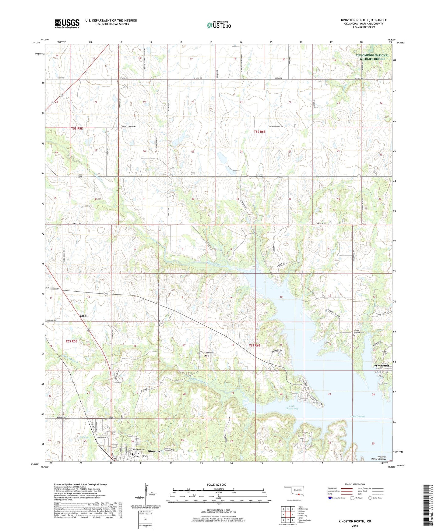
2022 topographic map quadrangle Kingston North in the state of Oklahoma. Scale: 1:24000. Based on the newly updated USGS 7.5' US Topo map series, this map is in the following counties: Marshall. The map contains contour data, water features, and other items you are used to seeing on USGS maps, but also has updated roads and other features. This is the next generation of topographic maps. Printed on high-quality waterproof paper with UV fade-resistant inks.
Quads adjacent to this one:
West: Madill
Northwest: Ravia
North: Tishomingo
Northeast: Milburn
East: Little City
Southeast: Platter
South: Kingston South
Southwest: Shay
This map covers the same area as the classic USGS quad with code o34096a6.
Contains the following named places: Aylesworth, Aylesworth Oil Field, Chickasaw Children's Village, Cliff Cemetery, Cushing Country Club Dam, Cushing Country Club Reservoir, Glasses Creek, Grantham Church, Kingston Cemetery, Kingston Elementary School, Kingston High School, Kingston Middle School, Little Glasses Bay, Little Glasses Creek, Madill Oil Field, Moore Burney Cemetery, North Madill Oil Field, Roosevelt Memorial Bridge, Town of Kingston