MyTopo
Madill Oklahoma US Topo Map
Couldn't load pickup availability
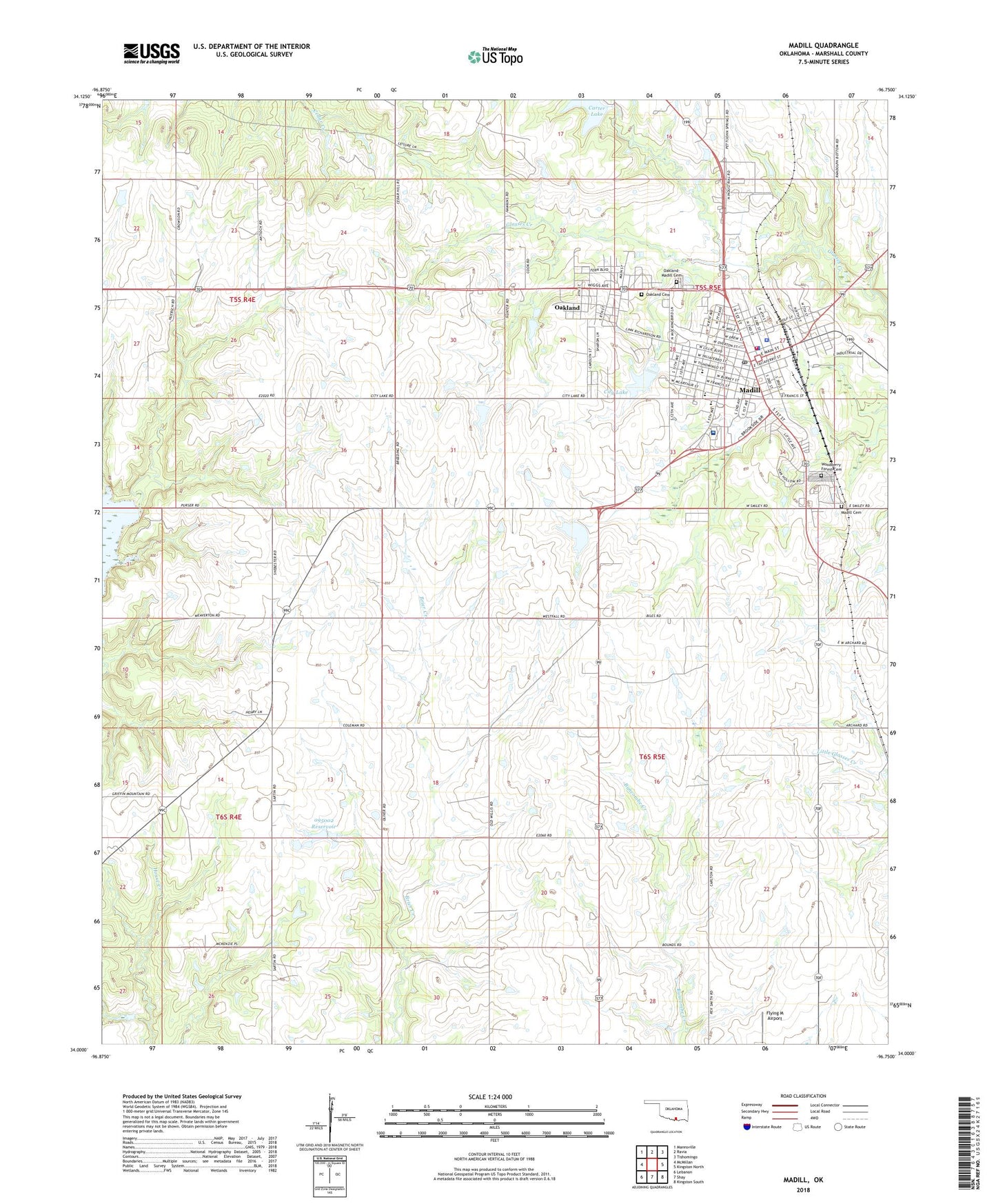
2022 topographic map quadrangle Madill in the state of Oklahoma. Scale: 1:24000. Based on the newly updated USGS 7.5' US Topo map series, this map is in the following counties: Marshall. The map contains contour data, water features, and other items you are used to seeing on USGS maps, but also has updated roads and other features. This is the next generation of topographic maps. Printed on high-quality waterproof paper with UV fade-resistant inks.
Quads adjacent to this one:
West: McMillan
Northwest: Mannsville
North: Ravia
Northeast: Tishomingo
East: Kingston North
Southeast: Kingston South
South: Shay
Southwest: Lebanon
This map covers the same area as the classic USGS quad with code o34096a7.
Contains the following named places: Antioch, Carter Lake Dam, Church of Christ, Church of the Nazarene, City Lake, City of Madill, Flying M Airport, Grace Baptist Church, Holy Cross Catholic Church, Integris Marshall County Medical Center, KMAD-AM (Madill), KMAD-FM (Madill), KXII-TV (Ardmore), Madill, Madill Cemetery, Madill City Lake Dam, Madill Elementary School, Madill Fire Department, Madill High School, Madill Middle School, Madill Police Department, Madill Post Office, Marshall County, Marshall County Emergency Medical Services District, Marshall County Jail, Marshall County Sheriff's Office, Memorial Park, North Marshall Division, Oakland, Oakland Cemetery, Oakland-Madill Cemetery, Oknoname 095002 Dam, Oknoname 095002 Reservoir, Town of Oakland, Township of Taliaferro, Woodberry Forest Cemetery, ZIP Code: 73446