MyTopo
Krebs Oklahoma US Topo Map
Couldn't load pickup availability
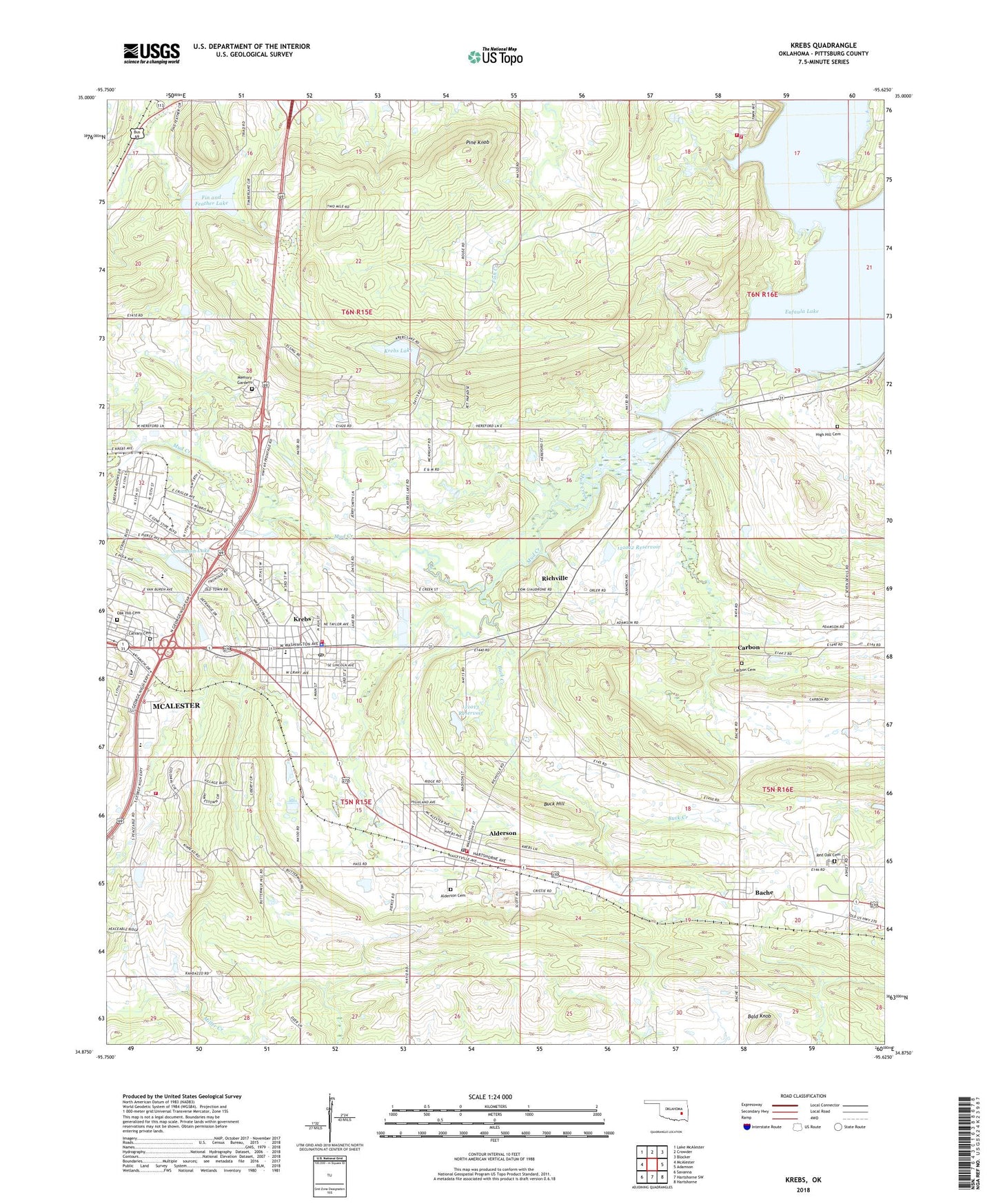
2018 topographic map quadrangle Krebs in the state of Oklahoma. Scale: 1:24000. Based on the newly updated USGS 7.5' US Topo map series, this map is in the following counties: Pittsburg. The map contains contour data, water features, and other items you are used to seeing on USGS maps, but also has updated roads and other features. This is the next generation of topographic maps. Printed on high-quality waterproof paper with UV fade-resistant inks.
Quads adjacent to this one:
West: McAlester
Northwest: Lake McAlester
North: Crowder
Northeast: Blocker
East: Adamson
Southeast: Hartshorne
South: Hartshorne SW
Southwest: Savanna
Contains the following named places: Alderson, Alderson Cemetery, Alderson Post Office, Alderson Volunteer Fire Department, Bache, Bache Census Designated Place, Bache Red Oak Cemetery, Bald Knob, Buck Creek, Buck Hill, Calvary Cemetery, Carbon, Carbon Cemetery, City of Krebs, Fin and Feather Lake, Fin Feather Lake Dam, Gaines Creek Volunteer Fire Department Station 1, Gaines Creek Volunteer Fire Department Station 2, High Hill Cemetery, High Hill Church, Highway 31 Landing Recreation Area, Kiamichi Technology Center Mcalester, KMCO-FM (McAlester), KNED-AM (McAlester), Krebs, Krebs Fire Department, Krebs Lake, Krebs Police Department, Krebs Post Office, Krebs Public School, Lakewood Christian School, Lakewood Christian School Church, McAlester High School, McAlester Regional Hospital Heliport, Memory Gardens, Mud Creek, Oak Hill Cemetery, Oknoname 121012 Dam, Oknoname 121012 Reservoir, Oknoname 121013 Dam, Oknoname 121013 Reservoir, Pine Knob, Pittsburg County, Richville, Richville Church, Smithson Lake, Smithson Lake Dam, Town of Alderson, ZIP Codes: 74522, 74554