MyTopo
Hartshorne SW Oklahoma US Topo Map
Couldn't load pickup availability
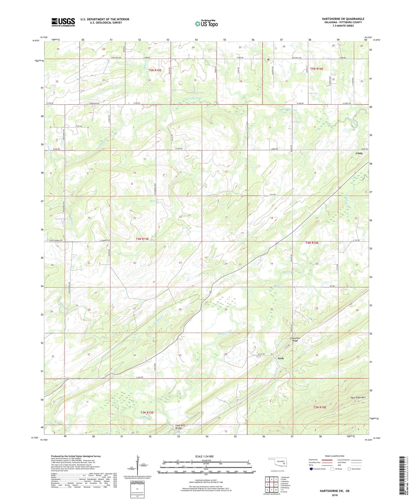
2022 topographic map quadrangle Hartshorne SW in the state of Oklahoma. Scale: 1:24000. Based on the newly updated USGS 7.5' US Topo map series, this map is in the following counties: Pittsburg. The map contains contour data, water features, and other items you are used to seeing on USGS maps, but also has updated roads and other features. This is the next generation of topographic maps. Printed on high-quality waterproof paper with UV fade-resistant inks.
Quads adjacent to this one:
West: Savanna
Northwest: McAlester
North: Krebs
Northeast: Adamson
East: Hartshorne
Southeast: Counts
South: Ti
Southwest: Pittsburg
This map covers the same area as the classic USGS quad with code o34095g6.
Contains the following named places: Anderson Creek, Arch, Arch Branch, Bond, Brier Creek, Brushy Church, Brushy Creek Baptist Church Cemetery, County District 11, Craig, Gardner Creek, High Hill Church, High Hill Volunteer Fire Association, Lime Arch Bridge, Miller Creek, New State Mountain, Peaceable Valley Church, Short Creek, Ti Creek, Wolf Creek