MyTopo
Hartshorne Oklahoma US Topo Map
Couldn't load pickup availability
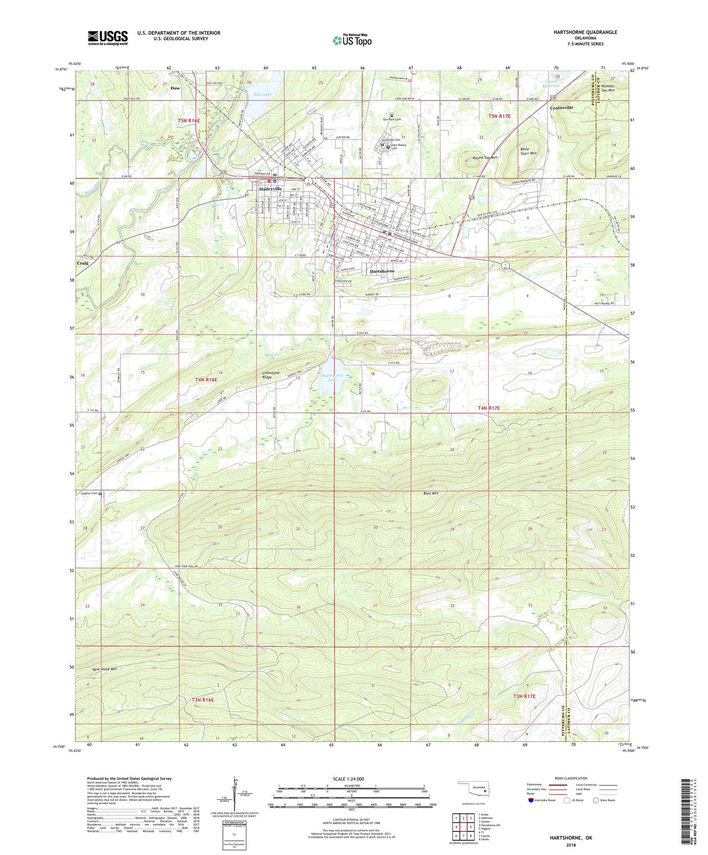
2022 topographic map quadrangle Hartshorne in the state of Oklahoma. Scale: 1:24000. Based on the newly updated USGS 7.5' US Topo map series, this map is in the following counties: Pittsburg, Latimer. The map contains contour data, water features, and other items you are used to seeing on USGS maps, but also has updated roads and other features. This is the next generation of topographic maps. Printed on high-quality waterproof paper with UV fade-resistant inks.
Quads adjacent to this one:
West: Hartshorne SW
Northwest: Krebs
North: Adamson
Northeast: Gowen
East: Higgins
Southeast: Sardis
South: Counts
Southwest: Ti
This map covers the same area as the classic USGS quad with code o34095g5.
Contains the following named places: Belle Starr Mountain, Blue Creek, Centerville, City of Haileyville, City of Hartshorne, Dow Lake, Elm Park Cemetery, Elmwood Cemetery, Flying A Ranch Airport, Haileyville, Haileyville Elementary School, Haileyville High School, Haileyville Police Department, Haileyville Post Office, Haileyville Volunteer Fire Department, Hartshorne, Hartshorne Elementary School, Hartshorne Emergency Medical Services, Hartshorne High School, Hartshorne Junior High School, Hartshorne Lake, Hartshorne Lake Dam, Hartshorne Police Department, Hartshorne Post Office, Hartshorne Volunteer Fire Department, Hartshorne-Haileyville Division, Holy Rosary Cemetery, Lone Oak School, Number Ten Mountain, Oknoname 121007 Dam, Oknoname 121007 Reservoir, Peaceable Creek, Round Top Mountain, Sulphur Cemetery, Township of Dow, ZIP Codes: 74546, 74547