MyTopo
Kremlin Oklahoma US Topo Map
Couldn't load pickup availability
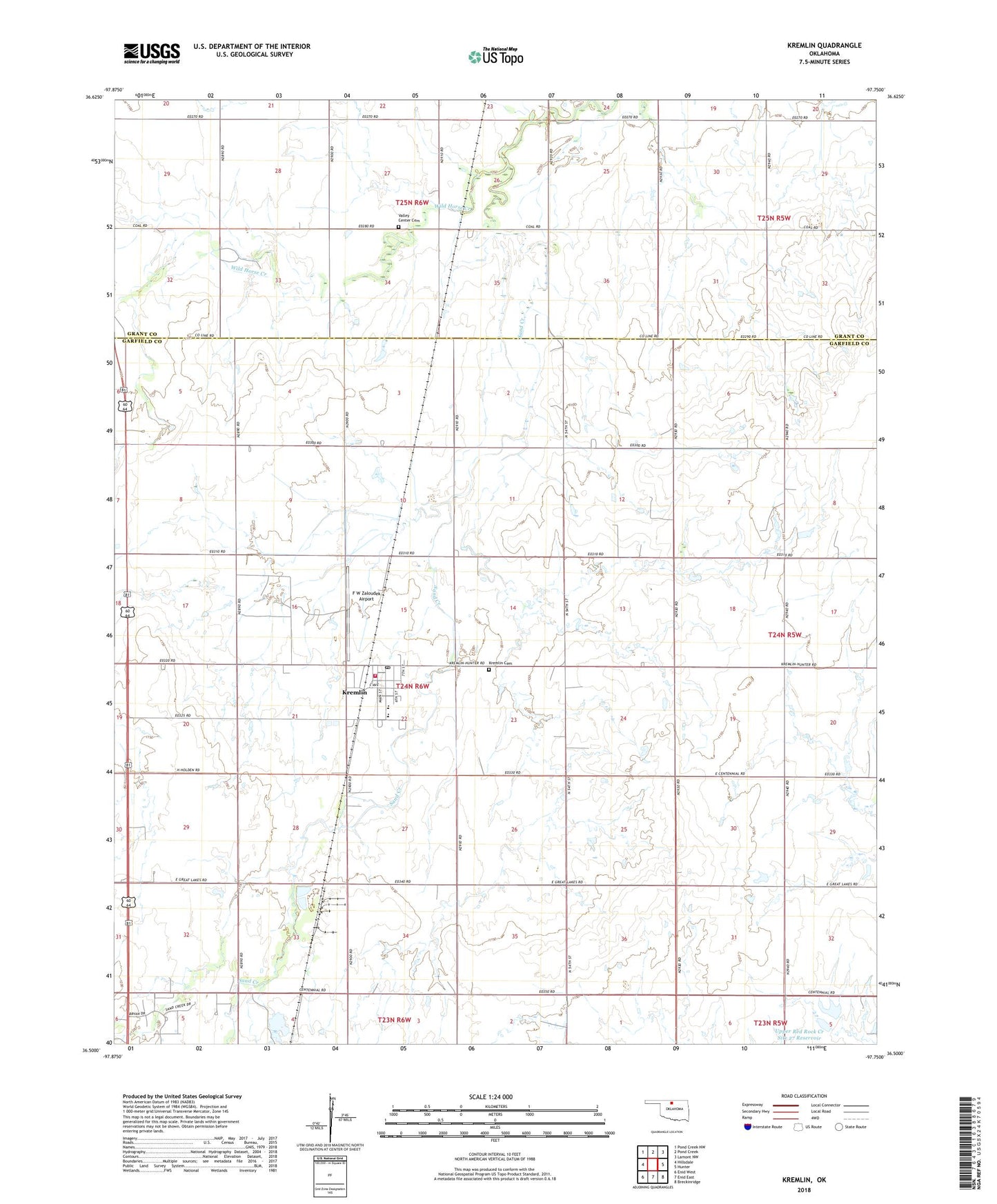
2018 topographic map quadrangle Kremlin in the state of Oklahoma. Scale: 1:24000. Based on the newly updated USGS 7.5' US Topo map series, this map is in the following counties: Garfield, Grant. The map contains contour data, water features, and other items you are used to seeing on USGS maps, but also has updated roads and other features. This is the next generation of topographic maps. Printed on high-quality waterproof paper with UV fade-resistant inks.
Quads adjacent to this one:
West: Hillsdale
Northwest: Pond Creek NW
North: Pond Creek
Northeast: Lamont NW
East: Hunter
Southeast: Breckinridge
South: Enid East
Southwest: Enid West
Contains the following named places: East Kremlin Gas Field, F W Zaloudek Airport, J-B Airstrip, Kremlin, Kremlin - Hillsdale Elementary School, Kremlin - Hillsdale High School, Kremlin Cemetery, Kremlin Fire Department, Kremlin Post Office, Ninemile Creek, North Garfield Division, Sand Creek, Town of Kremlin, Township of Kremlin, Upper Red Rock Creek Site 27 Dam, Upper Red Rock Creek Site 27 Reservoir, Valley Center Cemetery, ZIP Code: 73753