MyTopo
Lamont SE Oklahoma US Topo Map
Couldn't load pickup availability
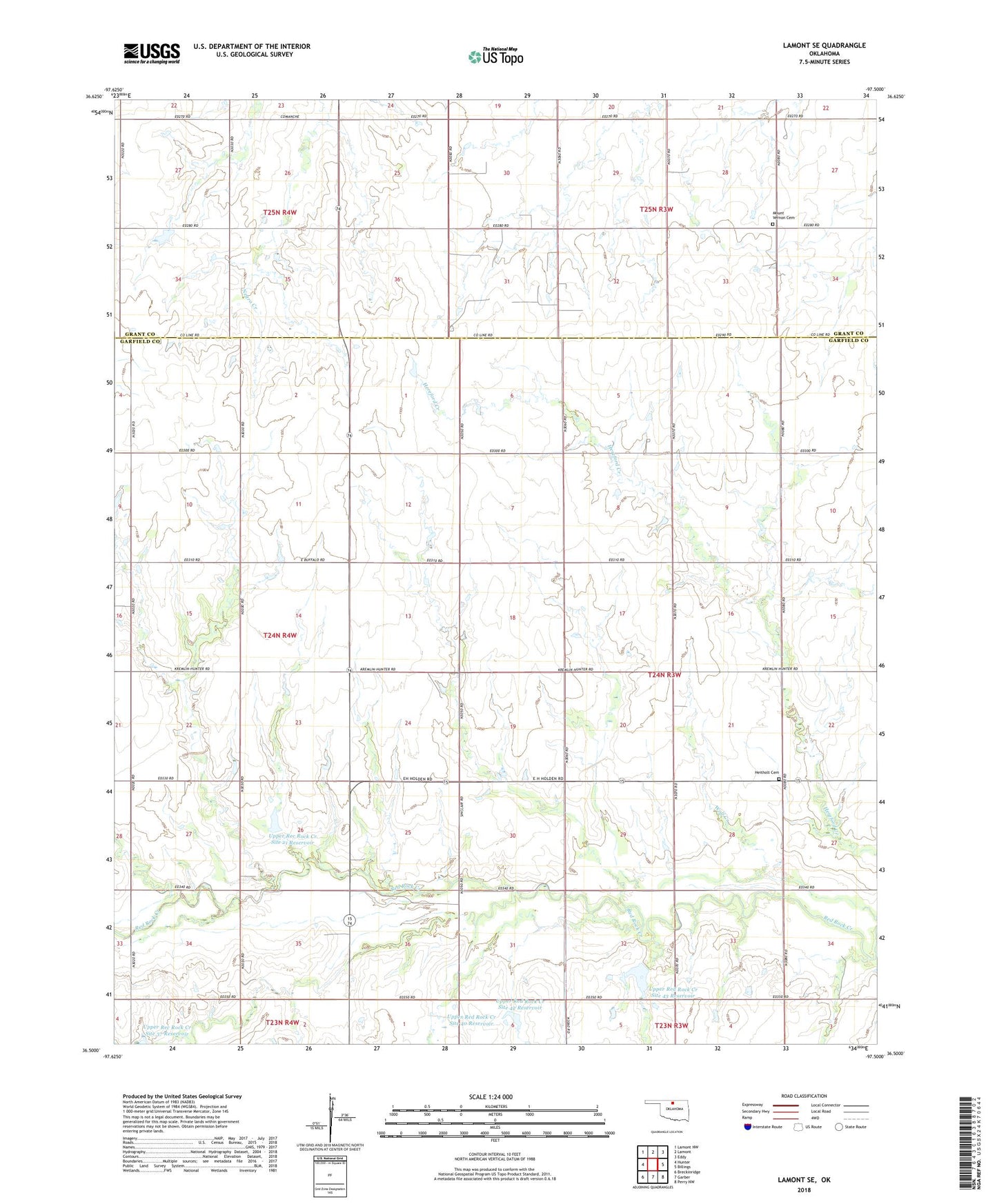
2018 topographic map quadrangle Lamont SE in the state of Oklahoma. Scale: 1:24000. Based on the newly updated USGS 7.5' US Topo map series, this map is in the following counties: Garfield, Grant. The map contains contour data, water features, and other items you are used to seeing on USGS maps, but also has updated roads and other features. This is the next generation of topographic maps. Printed on high-quality waterproof paper with UV fade-resistant inks.
Quads adjacent to this one:
West: Hunter
Northwest: Lamont NW
North: Lamont
Northeast: Eddy
East: Billings
Southeast: Perry NW
South: Garber
Southwest: Breckinridge
Contains the following named places: Bobbitt Airport, Heitholt Cemetery, Mount Vernon Cemetery, Southeast Salt Fork Oil Field, Township of Blaine, Township of Noble, Upper Rec Rock Creek Site 21 Reservoir, Upper Rec Rock Creek Site 37 Reservoir, Upper Red Rock Creek Site 18 Dam, Upper Red Rock Creek Site 18 Reservoir, Upper Red Rock Creek Site 20 Dam, Upper Red Rock Creek Site 20 Reservoir, Upper Red Rock Creek Site 21 Dam, Upper Red Rock Creek Site 22 Dam, Upper Red Rock Creek Site 22 Reservoir, Upper Red Rock Creek Site 40 Dam, Upper Red Rock Creek Site 40 Reservoir, Upper Red Rock Creek Site 42 Dam, Upper Red Rock Creek Site 42 Reservoir, Upper Red Rock Creek Site 43 Dam, Upper Red Rock Creek Site 43 Reservoir