MyTopo
Eddy Oklahoma US Topo Map
Couldn't load pickup availability
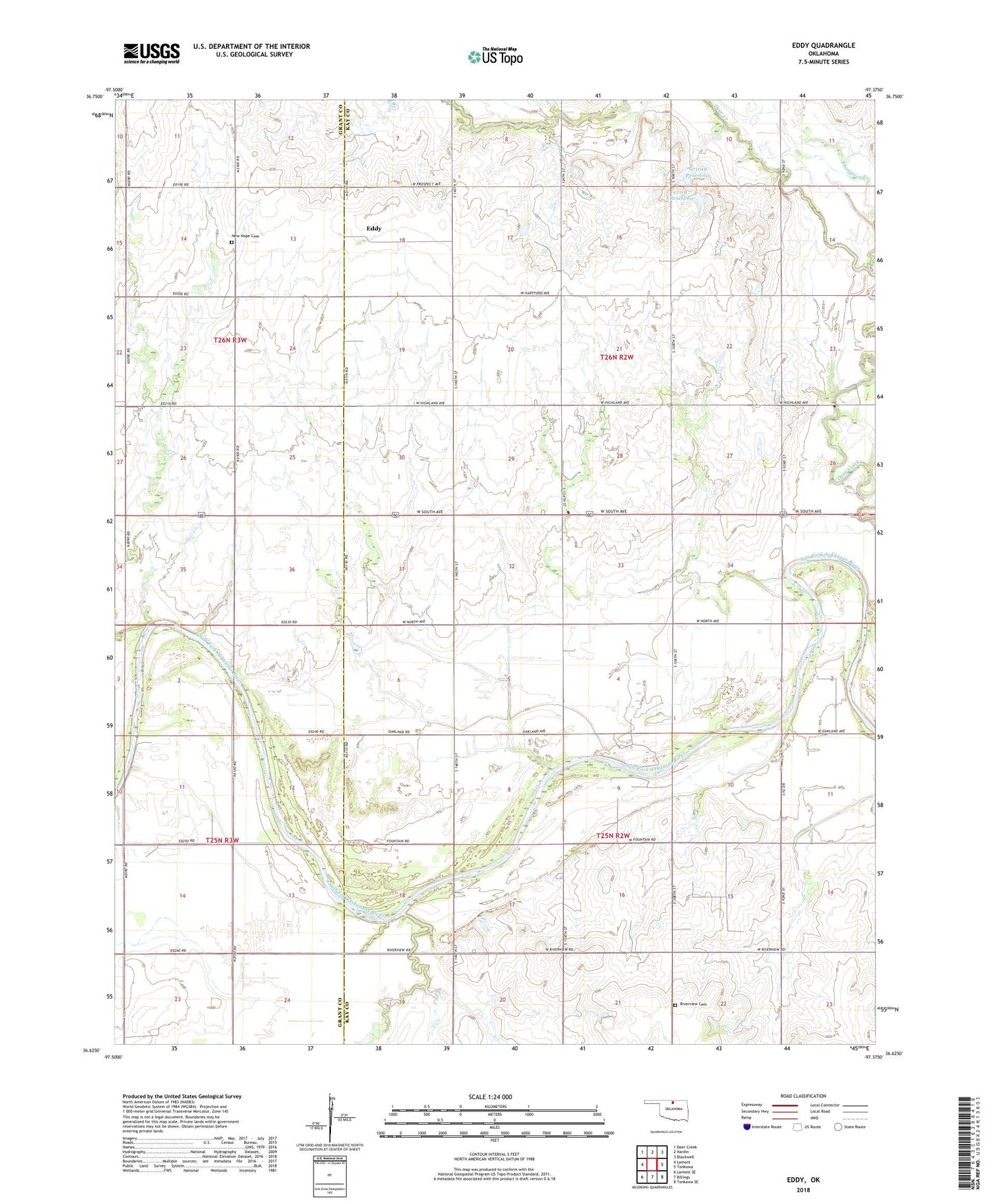
2022 topographic map quadrangle Eddy in the state of Oklahoma. Scale: 1:24000. Based on the newly updated USGS 7.5' US Topo map series, this map is in the following counties: Kay, Grant. The map contains contour data, water features, and other items you are used to seeing on USGS maps, but also has updated roads and other features. This is the next generation of topographic maps. Printed on high-quality waterproof paper with UV fade-resistant inks.
Quads adjacent to this one:
West: Lamont
Northwest: Deer Creek
North: Nardin
Northeast: Blackwell
East: Tonkawa
Southeast: Tonkawa SE
South: Billings
Southwest: Lamont SE
This map covers the same area as the classic USGS quad with code o36097f4.
Contains the following named places: Eddy, New Hope Cemetery, Oknoname 071017 Dam, Oknoname 071017 Reservoir, Oknoname 071018 Dam, Oknoname 071018 Reservoir, Peters Creek, Riverview Cemetery, Riverview Church, Thomas Oil Field, Thompson Creek, Township of Carlisle