MyTopo
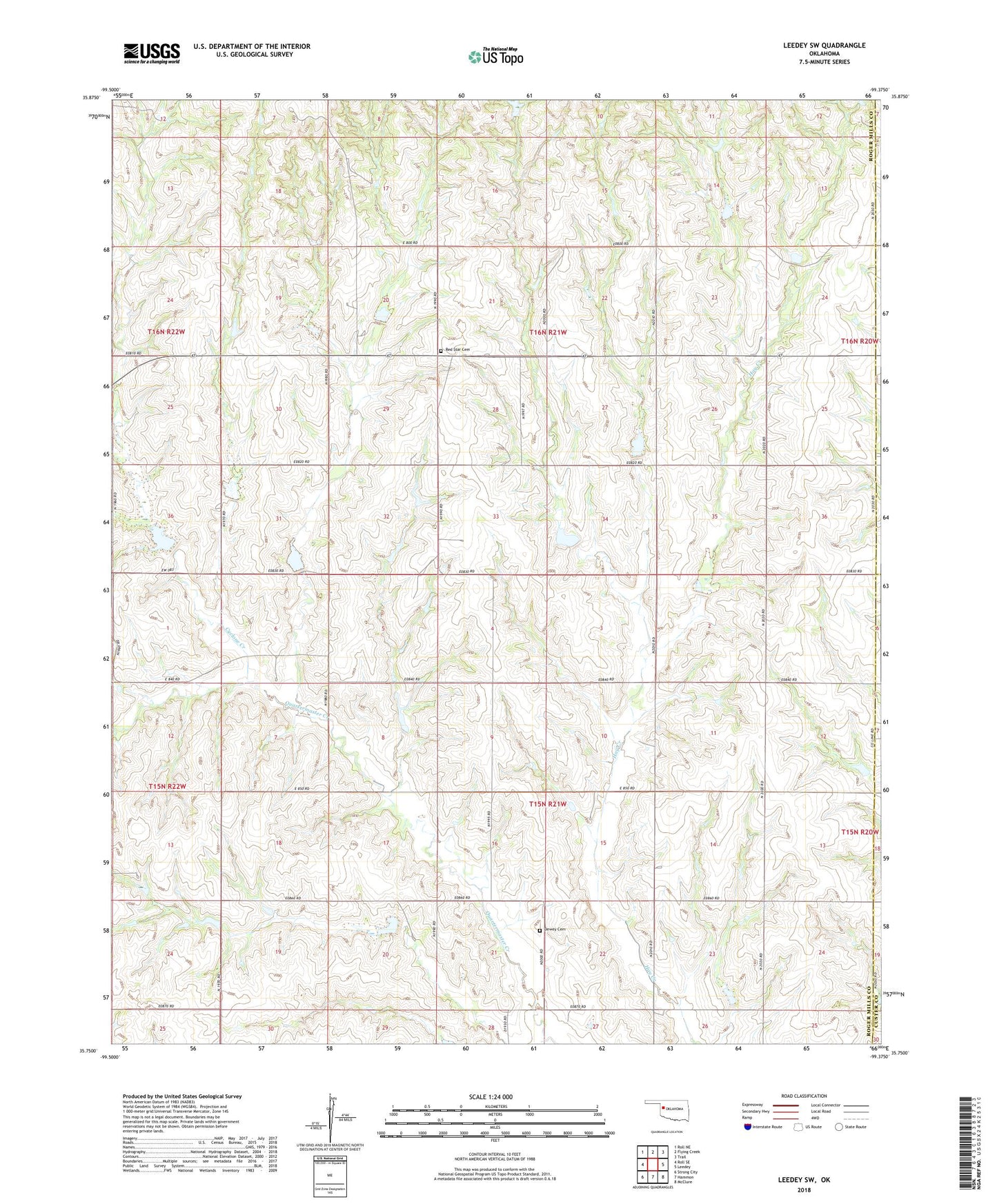
Leedey SW Oklahoma US Topo Map
Couldn't load pickup availability
2022 topographic map quadrangle Leedey SW in the state of Oklahoma. Scale: 1:24000. Based on the newly updated USGS 7.5' US Topo map series, this map is in the following counties: Roger Mills, Custer, Dewey. The map contains contour data, water features, and other items you are used to seeing on USGS maps, but also has updated roads and other features. This is the next generation of topographic maps. Printed on high-quality waterproof paper with UV fade-resistant inks.
Quads adjacent to this one:
West: Roll SE
Northwest: Roll NE
North: Flying Creek
Northeast: Trail
East: Leedey
Southeast: McClure
South: Hammon
Southwest: Strong City
This map covers the same area as the classic USGS quad with code o35099g4.
Contains the following named places: Angora, Cyclone Creek, Dewey Cemetery, Oknoname 129003 Dam, Oknoname 129003 Reservoir, Quartermaster Creek 1b Dam, Quartermaster Creek 1b Reservoir, Quartermaster Site 1 Dam, Quartermaster Site 1 Reservoir, Quartermaster Site 10 Dam, Quartermaster Site 10 Reservoir, Quartermaster Site 11 Dam, Quartermaster Site 11 Reservoir, Quartermaster Site 12 Dam, Quartermaster Site 12 Reservoir, Quartermaster Site 14 Dam, Quartermaster Site 14 Reservoir, Quartermaster Site 15 Dam, Quartermaster Site 15 Reservoir, Quartermaster Site 16 Dam, Quartermaster Site 16 Reservoir, Quartermaster Site 17 Dam, Quartermaster Site 17 Reservoir, Quartermaster Site 19a Dam, Quartermaster Site 19a Reservoir, Quartermaster Site 1a Dam, Quartermaster Site 1a Reservoir, Quartermaster Site 2 Dam, Quartermaster Site 2 Reservoir, Quartermaster Site 3 Dam, Quartermaster Site 3 Reservoir, Quartermaster Site 4 Dam, Quartermaster Site 4 Reservoir, Quartermaster Site 5 Dam, Quartermaster Site 5 Reservoir, Quartermaster Site 6 Dam, Quartermaster Site 6 Reservoir, Red Star Cemetery, Red Star Church, Township of Dewey