MyTopo
Cox City Oklahoma US Topo Map
Couldn't load pickup availability
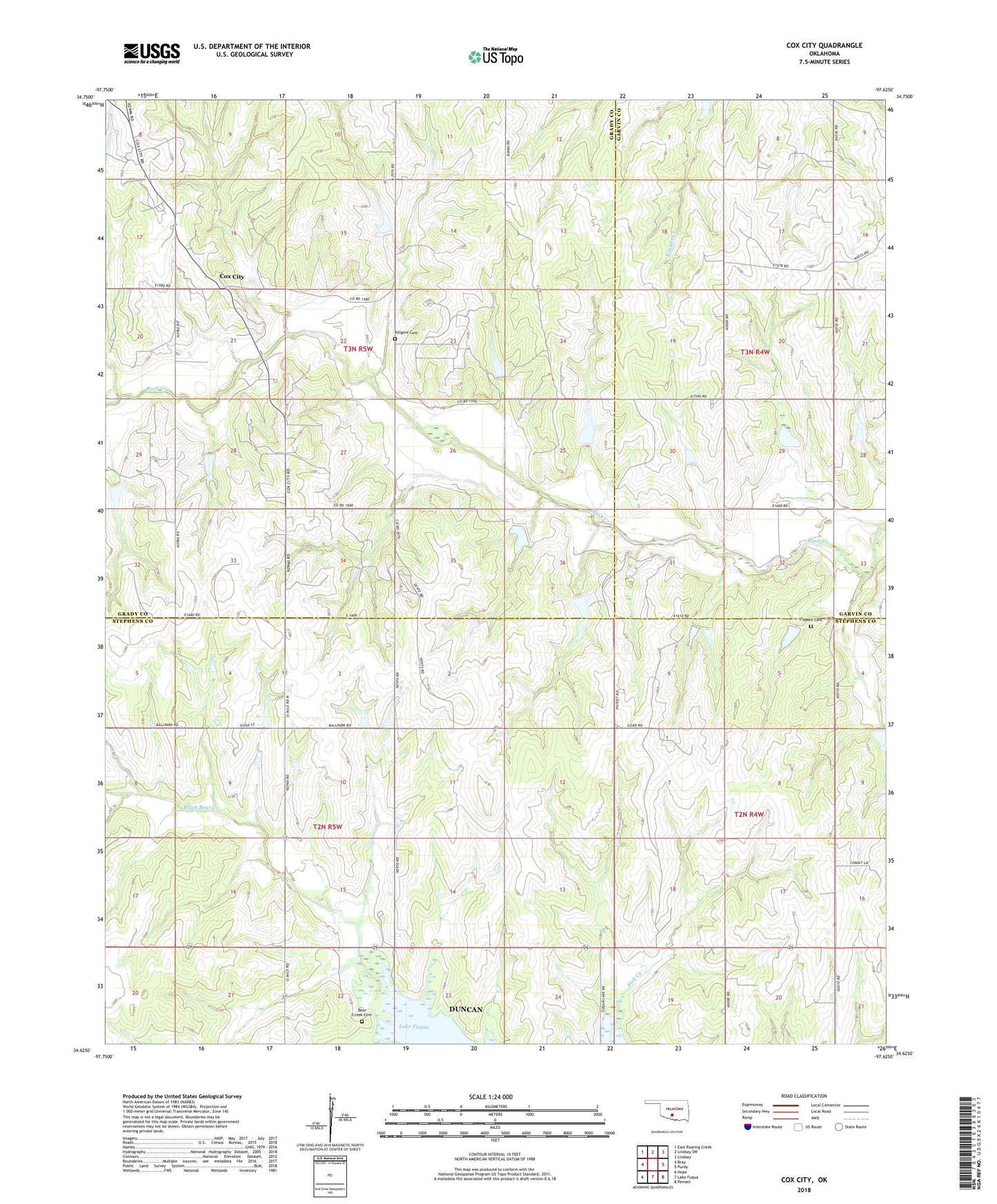
2022 topographic map quadrangle Cox City in the state of Oklahoma. Scale: 1:24000. Based on the newly updated USGS 7.5' US Topo map series, this map is in the following counties: Stephens, Grady, Garvin. The map contains contour data, water features, and other items you are used to seeing on USGS maps, but also has updated roads and other features. This is the next generation of topographic maps. Printed on high-quality waterproof paper with UV fade-resistant inks.
Quads adjacent to this one:
West: Bray
Northwest: East Roaring Creek
North: Lindsay SW
Northeast: Lindsay
East: Purdy
Southeast: Pernell
South: Lake Fuqua
Southwest: Hope
This map covers the same area as the classic USGS quad with code o34097f6.
Contains the following named places: Bear Creek Cemetery, Cox City, Cunningham Creek, Fish Creek, Killgore Cemetery, Ok Number Name 137094 Dam, Oknoname 051050 Dam, Oknoname 051050 Reservoir, Oknoname 137049 Dam, Oknoname 137049 Reservoir, Oknoname 137050 Dam, Oknoname 137050 Reservoir, Oknoname 137079 Dam, Oknoname 137079 Reservoir, Oknoname 137082 Dam, Oknoname 137082 Reservoir, Oknoname 137094 Reservoir, Pearl Church, Rush Creek Site 19 Dam, Rush Creek Site 19 Reservoir, Rush Creek Site 20 Dam, Rush Creek Site 20 Reservoir, Rush Creek Site 22 Dam, Rush Creek Site 22 Reservoir, Rush Creek Site 23 Dam, Rush Creek Site 23 Reservoir, Rush Creek Site 25 Dam, Rush Creek Site 25 Reservoir, Rush Creek Site 27 Dam, Rush Creek Site 27 Reservoir, Rush Creek Site 40 Dam, Rush Creek Site 40 Reservoir, Rush Creek Site 41 Dam, Rush Creek Site 41 Reservoir, Rush Creek Site 42 Dam, Rush Creek Site 42 Reservoir, Rush Creek Site 46 Dam, Rush Creek Site 46 Reservoir, Rush Creek Site Number 21 Dam, Rush Creek Site Number 21 Reservoir, Tidwell Cemetery, Township of Harrison, Upper Clear Boggy Number 27 Dam, Upper Clear Boggy Number 27 Reservoir