MyTopo
Loco Oklahoma US Topo Map
Couldn't load pickup availability
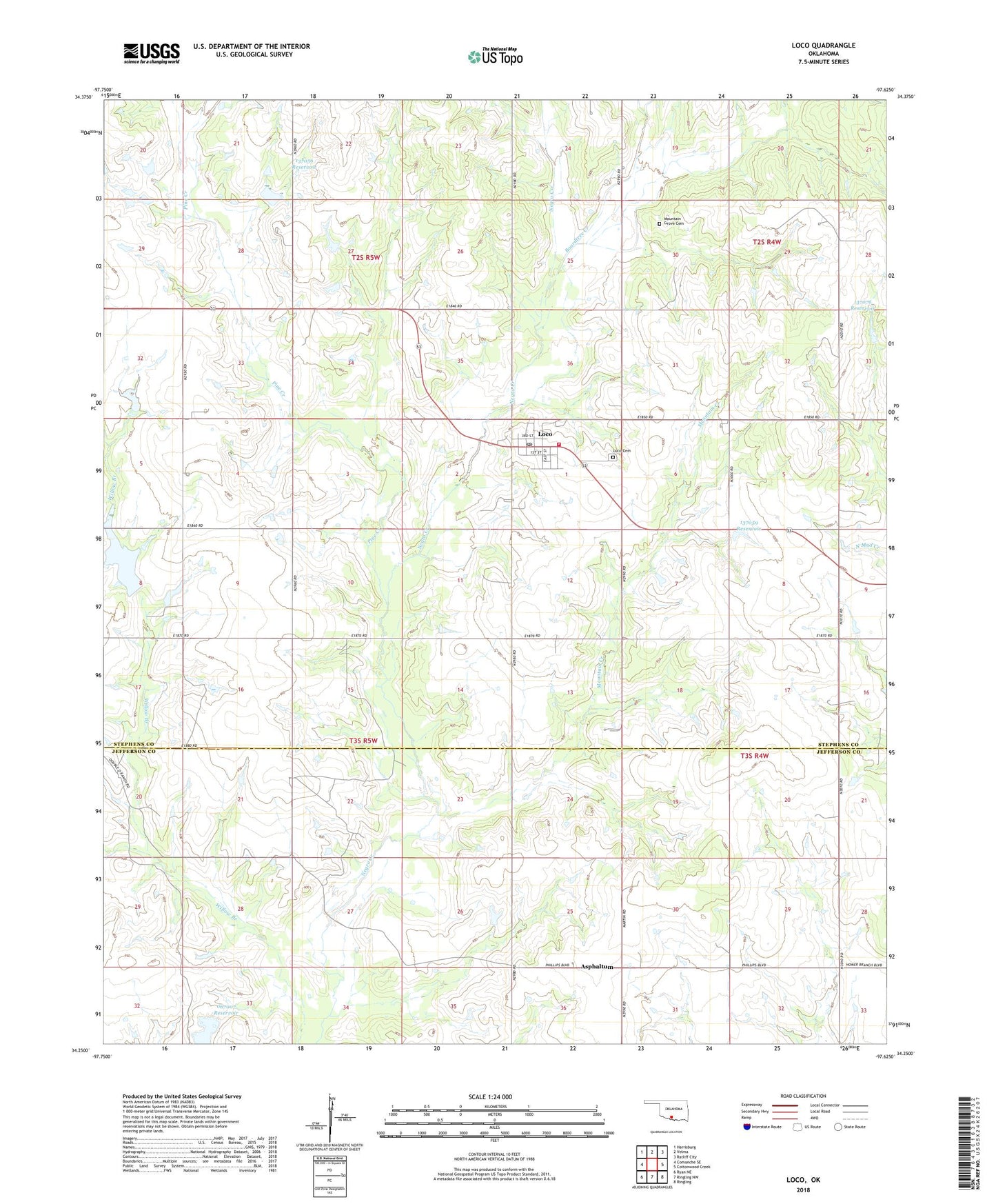
2018 topographic map quadrangle Loco in the state of Oklahoma. Scale: 1:24000. Based on the newly updated USGS 7.5' US Topo map series, this map is in the following counties: Stephens, Jefferson. The map contains contour data, water features, and other items you are used to seeing on USGS maps, but also has updated roads and other features. This is the next generation of topographic maps. Printed on high-quality waterproof paper with UV fade-resistant inks.
Quads adjacent to this one:
West: Comanche SE
Northwest: Harrisburg
North: Velma
Northeast: Ratliff City
East: Cottonwood Creek
Southeast: Ringling
South: Ringling NW
Southwest: Ryan NE
Contains the following named places: Asphaltum, Boardtree Creek, Conoco Lake, Conoco Lake Dam, Loco, Loco Cemetery, Loco Post Office, Loco Volunteer Fire Department, Mountain Creek, Mountain Grove Cemetery, Ok Number Name 137081 Dam, Oknoname 067007 Reservoir, Oknoname 137056 Dam, Oknoname 137056 Reservoir, Oknoname 137057 Dam, Oknoname 137057 Reservoir, Oknoname 137059 Dam, Oknoname 137059 Reservoir, Oknoname 137075 Dam, Oknoname 137075 Reservoir, Oknoname 137076 Dam, Oknoname 137076 Reservoir, Oknoname 137077 Dam, Oknoname 137077 Reservoir, Oknoname 137081 Reservoir, Pine Creek, Town of Loco, Township of Loco, ZIP Code: 73442