MyTopo
Harrisburg Oklahoma US Topo Map
Couldn't load pickup availability
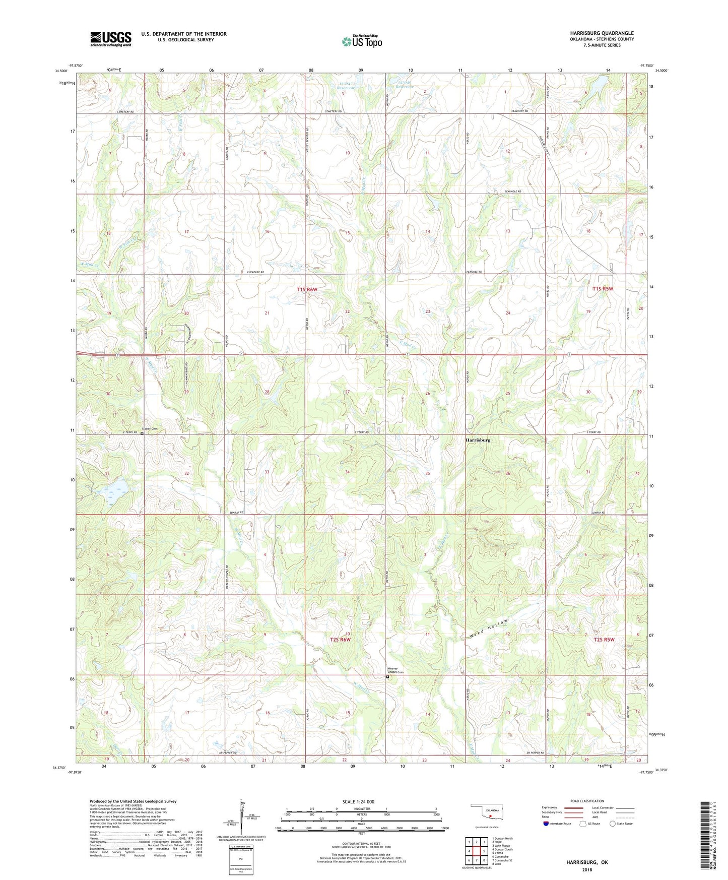
2022 topographic map quadrangle Harrisburg in the state of Oklahoma. Scale: 1:24000. Based on the newly updated USGS 7.5' US Topo map series, this map is in the following counties: Stephens. The map contains contour data, water features, and other items you are used to seeing on USGS maps, but also has updated roads and other features. This is the next generation of topographic maps. Printed on high-quality waterproof paper with UV fade-resistant inks.
Quads adjacent to this one:
West: Duncan South
Northwest: Duncan North
North: Hope
Northeast: Lake Fuqua
East: Velma
Southeast: Loco
South: Comanche SE
Southwest: Comanche
This map covers the same area as the classic USGS quad with code o34097d7.
Contains the following named places: Fairview Church, Harrisburg, Northwest Palacine Oil Field, Oknoname 137045 Dam, Oknoname 137046 Reservoir, Oknoname 137047 Dam, Oknoname 137047 Reservoir, Oknoname 137048 Dam, Oknoname 137048 Reservoir, Oknoname 137083 Dam, Oknoname 137083 Reservoir, Oknoname 137093 Dam, Oknoname 137093 Reservoir, Stephens County, Stoner Cemetery, Township of King, Valley View Church, Weaver Chapel Cemetery, Weed Hollow, West Velma Oil Field, Wildhorse Creek Site 18 Dam, Wildhorse Creek Site 18 Reservoir