MyTopo
Velma Oklahoma US Topo Map
Couldn't load pickup availability
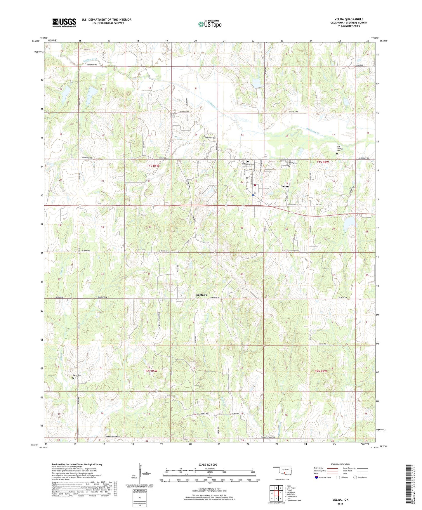
2022 topographic map quadrangle Velma in the state of Oklahoma. Scale: 1:24000. Based on the newly updated USGS 7.5' US Topo map series, this map is in the following counties: Stephens. The map contains contour data, water features, and other items you are used to seeing on USGS maps, but also has updated roads and other features. This is the next generation of topographic maps. Printed on high-quality waterproof paper with UV fade-resistant inks.
Quads adjacent to this one:
West: Harrisburg
Northwest: Hope
North: Lake Fuqua
Northeast: Pernell
East: Ratliff City
Southeast: Cottonwood Creek
South: Loco
Southwest: Comanche SE
This map covers the same area as the classic USGS quad with code o34097d6.
Contains the following named places: Country Side Church, Humphrey Park, Oknoname 137055 Dam, Oknoname 137055 Reservoir, Old Jackson Cemetery, Old Velma Cemetery, Parks Cemetery, Passmore Cemetery, Santa Fe, Town of Velma, Township of Parks, Velma, Velma - Alma Elementary School, Velma - Alma High School, Velma - Alma Middle School, Velma Cemetery, Velma Community Ambulance, Velma Police Department, Velma Post Office, Velma Volunteer Fire Department, Velma-Alma Division, Wildhorse Creek Site 15 Dam, Wildhorse Creek Site 15 Reservoir, Wildhorse Creek Site 16 Dam, Wildhorse Creek Site 16 Reservoir, Wildhorse Creek Site 17 Dam, Wildhorse Creek Site 17 Reservoir, Wildhorse Creek Site 35 Dam, Wildhorse Creek Site 35 Reservoir, Wildhorse Creek Site 36 Dam, Wildhorse Creek Site 36 Reservoir, ZIP Code: 73491