MyTopo
Marland Oklahoma US Topo Map
Couldn't load pickup availability
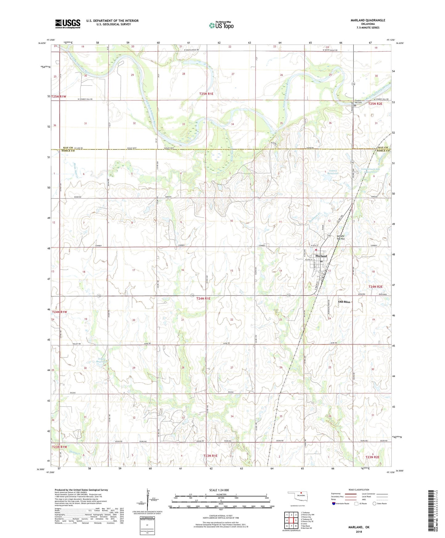
2018 topographic map quadrangle Marland in the state of Oklahoma. Scale: 1:24000. Based on the newly updated USGS 7.5' US Topo map series, this map is in the following counties: Noble, Kay. The map contains contour data, water features, and other items you are used to seeing on USGS maps, but also has updated roads and other features. This is the next generation of topographic maps. Printed on high-quality waterproof paper with UV fade-resistant inks.
Quads adjacent to this one:
West: Tonkawa SE
Northwest: Tonkawa
North: Ponca City NW
Northeast: Ponca City
East: Ponca City SE
Southeast: Morrison NE
South: Red Rock
Southwest: Ceres
Contains the following named places: Birds Nest Creek, Ceres South Oil Field, Chikaskia River, Cowboy Hill Cemetery, Horseshoe Lake, Longbranch Site 2 Dam, Longbranch Site 2 Reservoir, Marland, Marland Post Office, Marland Volunteer Fire Department, Oknoname 103011 Dam, Oknoname 103011 Reservoir, Oknoname 103012 Dam, Oknoname 103012 Reservoir, Old Bliss, Spindle Top Hill, Three Sands Oil Field, Town of Marland, Township of Buffalo