MyTopo
Ponca City NW Oklahoma US Topo Map
Couldn't load pickup availability
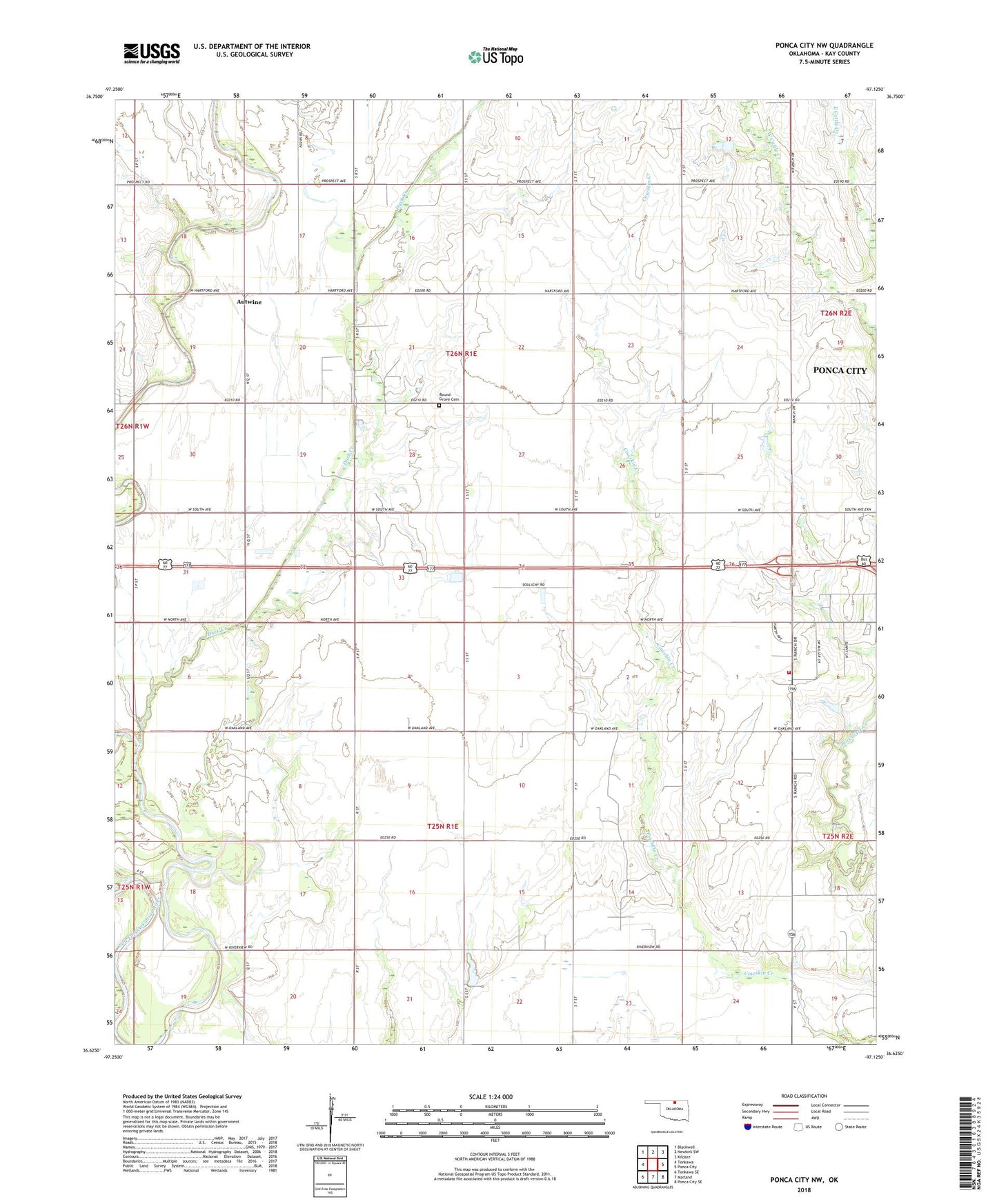
2022 topographic map quadrangle Ponca City NW in the state of Oklahoma. Scale: 1:24000. Based on the newly updated USGS 7.5' US Topo map series, this map is in the following counties: Kay. The map contains contour data, water features, and other items you are used to seeing on USGS maps, but also has updated roads and other features. This is the next generation of topographic maps. Printed on high-quality waterproof paper with UV fade-resistant inks.
Quads adjacent to this one:
West: Tonkawa
Northwest: Blackwell
North: Newkirk SW
Northeast: Kildare
East: Ponca City
Southeast: Ponca City SE
South: Marland
Southwest: Tonkawa SE
This map covers the same area as the classic USGS quad with code o36097f2.
Contains the following named places: Antwine Lake, Antwine Lake Dam, Autwine, Autwine Oil Field, Duck Creek, Finley School, Kaw/Ponca Joint-Use Oklahoma Tribal Statistical Area, Ranch Drive Church, Ranch Drive Rural Fire Department, Round Grove Cemetery, Southwest Ponca City Oil Field, Township of Miller, Township of Round Grove, West Autwine Oil Field, ZIP Code: 74601