MyTopo
Red Rock Oklahoma US Topo Map
Couldn't load pickup availability
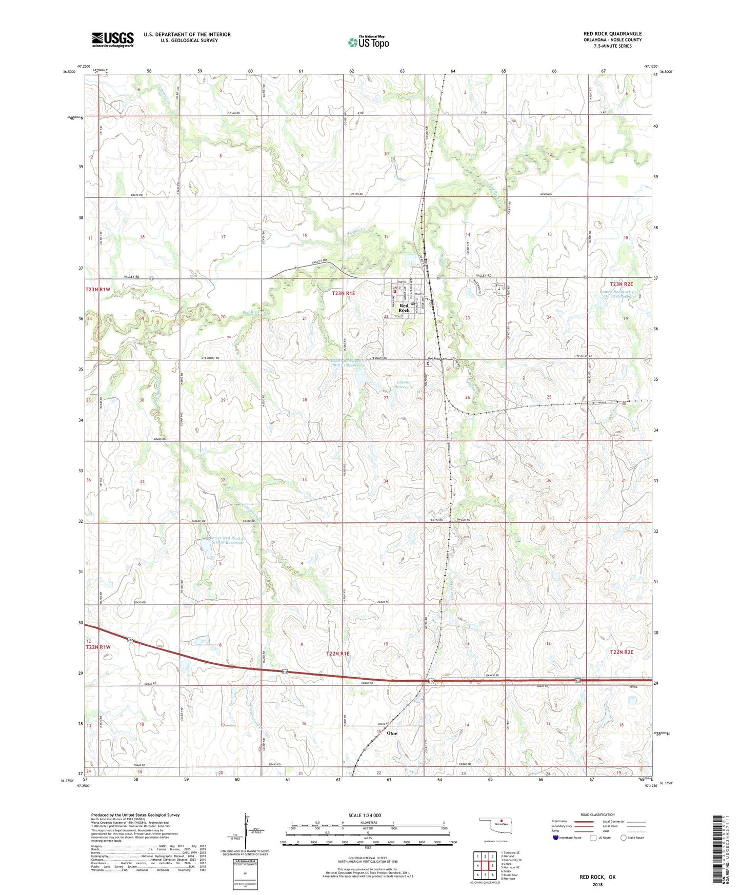
2022 topographic map quadrangle Red Rock in the state of Oklahoma. Scale: 1:24000. Based on the newly updated USGS 7.5' US Topo map series, this map is in the following counties: Noble. The map contains contour data, water features, and other items you are used to seeing on USGS maps, but also has updated roads and other features. This is the next generation of topographic maps. Printed on high-quality waterproof paper with UV fade-resistant inks.
Quads adjacent to this one:
West: Ceres
Northwest: Tonkawa SE
North: Marland
Northeast: Ponca City SE
East: Morrison NE
Southeast: Morrison
South: Black Bear
Southwest: Perry
This map covers the same area as the classic USGS quad with code o36097d2.
Contains the following named places: Cottonwood Creek, Frontier Elementary School, Frontier High School, Legend Creek, Lower Red Rock Creek Site 18 Dam, Lower Red Rock Creek Site 18 Reservoir, Lower Red Rock Creek Site 21 Dam, Lower Red Rock Creek Site 21 Reservoir, Lower Red Rock Creek Site 23 Dam, Lower Red Rock Creek Site 23 Reservoir, Noble County, Oknoname 103006 Dam, Oknoname 103006 Reservoir, Otoe, Red Rock, Red Rock Cemetery, Red Rock Post Office, Red Rock Rural Fire Association, Skinny Creek, Town of Red Rock, Township of Carson, Township of Santa Fe, ZIP Code: 74651