MyTopo
Masham Oklahoma US Topo Map
Couldn't load pickup availability
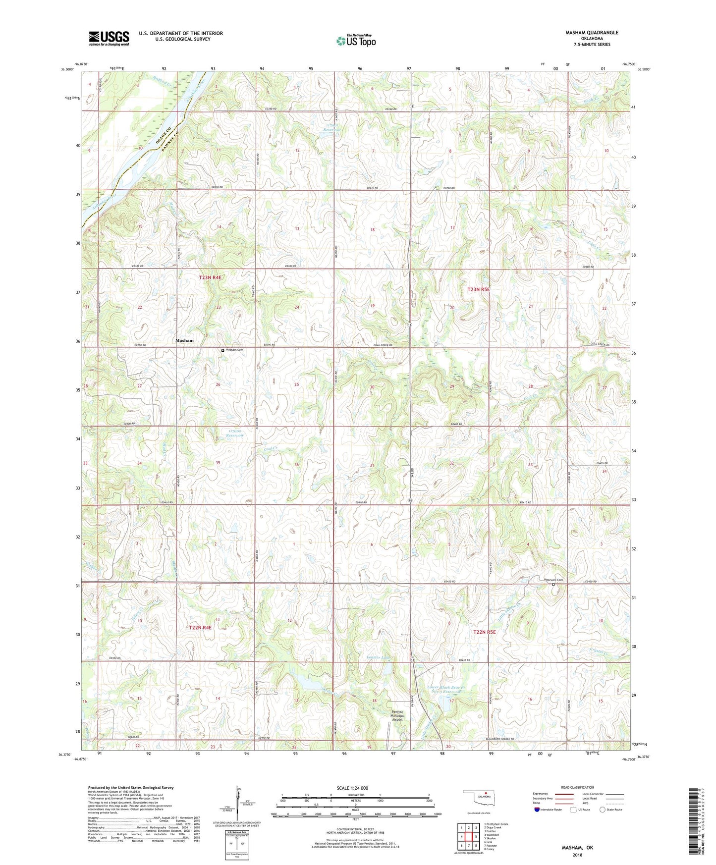
2018 topographic map quadrangle Masham in the state of Oklahoma. Scale: 1:24000. Based on the newly updated USGS 7.5' US Topo map series, this map is in the following counties: Pawnee, Osage. The map contains contour data, water features, and other items you are used to seeing on USGS maps, but also has updated roads and other features. This is the next generation of topographic maps. Printed on high-quality waterproof paper with UV fade-resistant inks.
Quads adjacent to this one:
West: Watchorn
Northwest: Prettyhair Creek
North: Doga Creek
Northeast: Fairfax
East: Skedee
Southeast: Casey
South: Pawnee
Southwest: Lela
Contains the following named places: Feaster Lake, Feaster Lake Dam, Hopewell Cemetery, Lower Black Bear Creek Site 3 Dam, Lower Black Bear Creek Site 3 Reservoir, Lower Black Bear Creek Site 4 Dam, Lower Black Bear Creek Site 4 Reservoir, Masham, Masham Cemetery, Mud Creek, Oknoname 117001 Dam, Oknoname 117001 Reservoir, Oknoname 117002 Dam, Oknoname 117002 Reservoir, Pawnee Municipal Airport, Township of Coal Creek, Township of Eagle, ZIP Code: 74650