MyTopo
Casey Oklahoma US Topo Map
Couldn't load pickup availability
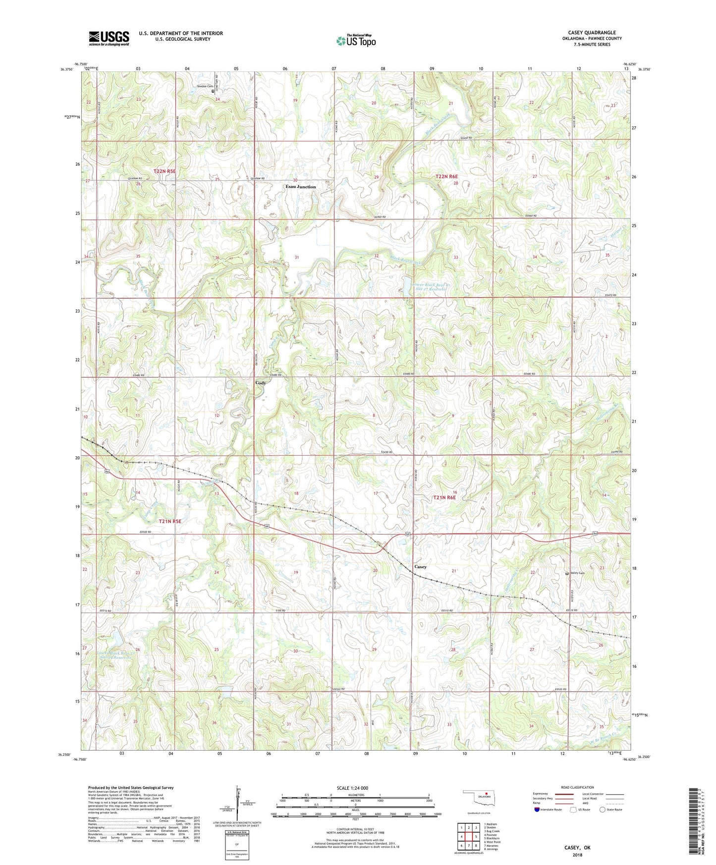
2022 topographic map quadrangle Casey in the state of Oklahoma. Scale: 1:24000. Based on the newly updated USGS 7.5' US Topo map series, this map is in the following counties: Pawnee. The map contains contour data, water features, and other items you are used to seeing on USGS maps, but also has updated roads and other features. This is the next generation of topographic maps. Printed on high-quality waterproof paper with UV fade-resistant inks.
Quads adjacent to this one:
West: Pawnee
Northwest: Masham
North: Skedee
Northeast: Bug Creek
East: Blackburn
Southeast: Jennings
South: Maramec
Southwest: West Point
This map covers the same area as the classic USGS quad with code o36096c6.
Contains the following named places: Camp Creek, Casey, Cody, Esau Junction, Lower Black Bear Creek Site 24 Dam, Lower Black Bear Creek Site 24 Reservoir, Lower Black Bear Creek Site 26 Dam, Lower Black Bear Creek Site 26 Reservoir, Lower Black Bear Creek Site 27 Dam, Lower Black Bear Creek Site 27 Reservoir, Pawnee County, Pawnee Oklahoma Tribal Statistical Area, Skedee Cemetery, Valley Cemetery