MyTopo
Fairfax Oklahoma US Topo Map
Couldn't load pickup availability
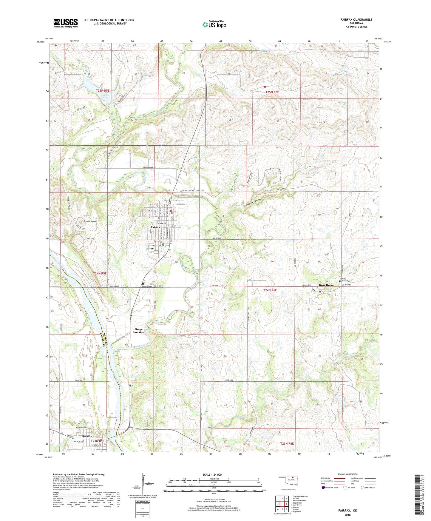
2022 topographic map quadrangle Fairfax in the state of Oklahoma. Scale: 1:24000. Based on the newly updated USGS 7.5' US Topo map series, this map is in the following counties: Osage, Pawnee. The map contains contour data, water features, and other items you are used to seeing on USGS maps, but also has updated roads and other features. This is the next generation of topographic maps. Printed on high-quality waterproof paper with UV fade-resistant inks.
Quads adjacent to this one:
West: Doga Creek
Northwest: Charley Creek East
North: Burbank
Northeast: Baconrind Creek
East: Lucy Creek
Southeast: Bug Creek
South: Skedee
Southwest: Masham
This map covers the same area as the classic USGS quad with code o36096e6.
Contains the following named places: Christian Church, Church of Nazarene, Eagle Creek, Fairfax, Fairfax Cemetery, Fairfax City Lake, Fairfax Community Hospital, Fairfax Dam, Fairfax Division, Fairfax Heliport, Fairfax Police Department, Fairfax Post Office, Fairfax Volunteer Fire Department, First Osage Baptist Church, First United Methodist Church, Geyhorse Indian Village Cemetery, Gray Horse, Grayhorse Fire Protection, Haskell Cemetery, Kah-Wah-C Golf Course, Little Chief Rural Fire Company, New Hope Christian Fellowship Church, Osage Junction, Ralston, Ralston Post Office, Ralston Volunteer Fire Department, Round Mound, Salt Creek, Seven Bar Ranch Airport, Sweet Home Baptist Church, Tate Creek, Threemile Canyon, Town of Fairfax, Town of Ralston, Wild Creek, Woodland Elementary School, Woodland High School, Woodland Upper Elementary School, ZIP Code: 74637