MyTopo
Lela Oklahoma US Topo Map
Couldn't load pickup availability
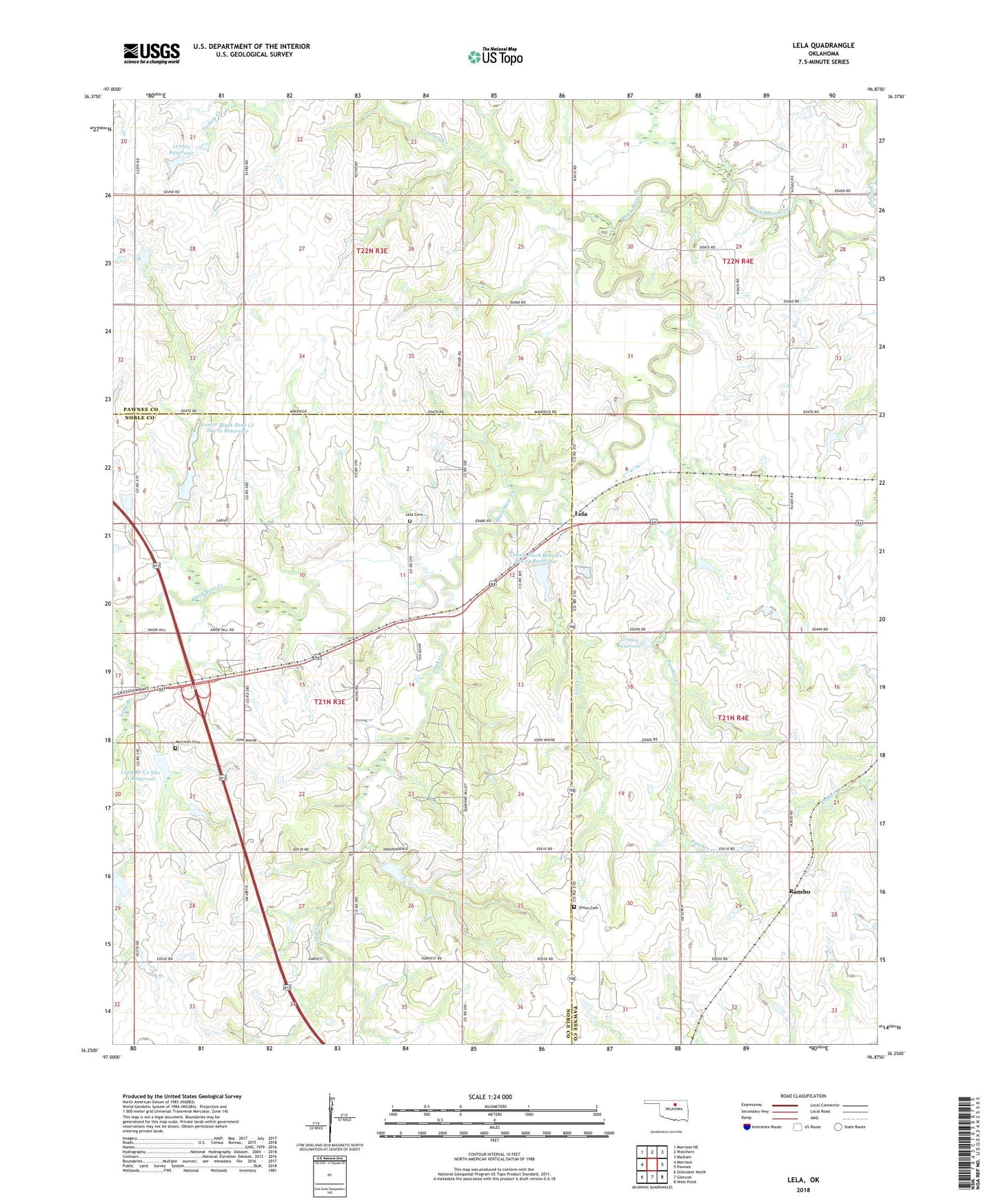
2022 topographic map quadrangle Lela in the state of Oklahoma. Scale: 1:24000. Based on the newly updated USGS 7.5' US Topo map series, this map is in the following counties: Pawnee, Noble. The map contains contour data, water features, and other items you are used to seeing on USGS maps, but also has updated roads and other features. This is the next generation of topographic maps. Printed on high-quality waterproof paper with UV fade-resistant inks.
Quads adjacent to this one:
West: Morrison
Northwest: Morrison NE
North: Watchorn
Northeast: Masham
East: Pawnee
Southeast: West Point
South: Glencoe
Southwest: Stillwater North
This map covers the same area as the classic USGS quad with code o36096c8.
Contains the following named places: Baptist Church Camp, Indian Cemetery, Lela, Lela Cemetery, Lighthouse Temple, Lion Creek, Long Branch, Long Branch Creek Site 11 Dam, Long Branch Creek Site 11 Reservoir, Long Branch Watershed Site 11 Dam, Lower Black Bear Creek Site 11 Dam, Lower Black Bear Creek Site 11 Reservoir, Lower Black Bear Creek Site 14 Dam, Lower Black Bear Creek Site 14 Reservoir, Lower Black Bear Creek Site 6 Dam, Lower Black Bear Creek Site 6 Reservoir, Morrison Cemetery, Oak Creek, Oknoname 117003 Dam, Oknoname 117003 Reservoir, Oknoname 117004 Dam, Oknoname 117004 Reservoir, Panther Creek, Rambo, Township of Autry, Union Cemetery