MyTopo
Morris Oklahoma US Topo Map
Couldn't load pickup availability
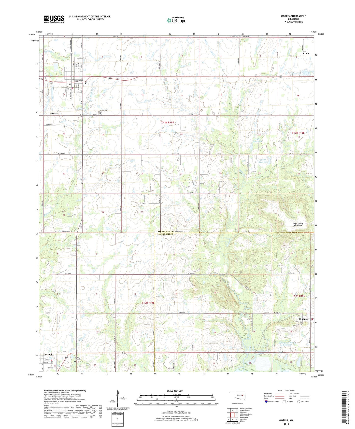
2018 topographic map quadrangle Morris in the state of Oklahoma. Scale: 1:24000. Based on the newly updated USGS 7.5' US Topo map series, this map is in the following counties: Okmulgee, McIntosh. The map contains contour data, water features, and other items you are used to seeing on USGS maps, but also has updated roads and other features. This is the next generation of topographic maps. Printed on high-quality waterproof paper with UV fade-resistant inks.
Quads adjacent to this one:
West: Okmulgee South
Northwest: Okmulgee North
North: Okmulgee NE
Northeast: Boynton
East: Council Hill
Southeast: Pierce
South: Hoffman
Southwest: Henryetta
Contains the following named places: Church of Christ, City of Morris, Eram, First Baptist Church, First Christian Church Parsonage, Grave Creek Church, Grayson, Grayson Volunteer Fire Department, High Spring Mountains, Hitchita, Hitchita Area Fire Protection, Indian Cemetery, Methodist Church, Midway Elementary School, Morris, Morris Cemetery, Morris Elementary School, Morris Fire Department, Morris High School, Morris Middle School, Morris Police Department, Morris Post Office, Oknoname 111075 Dam, Oknoname 111075 Reservoir, Oknoname 111076 Dam, Oknoname 111076 Reservoir, Sacred Heart Cemetery, Sallisaw Creek Site 34 Dam, Sallisaw Creek Site 34 Reservoir, Town of Grayson, Town of Hitchita, Township of Morris, United Pentecostal Church, ZIP Code: 74438