MyTopo
Morrison NE Oklahoma US Topo Map
Couldn't load pickup availability
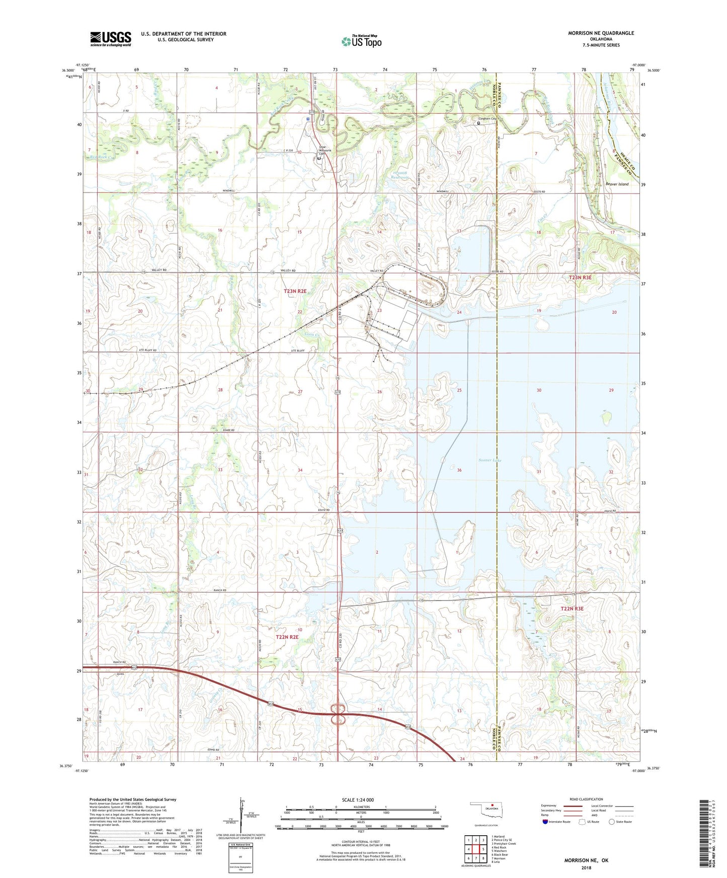
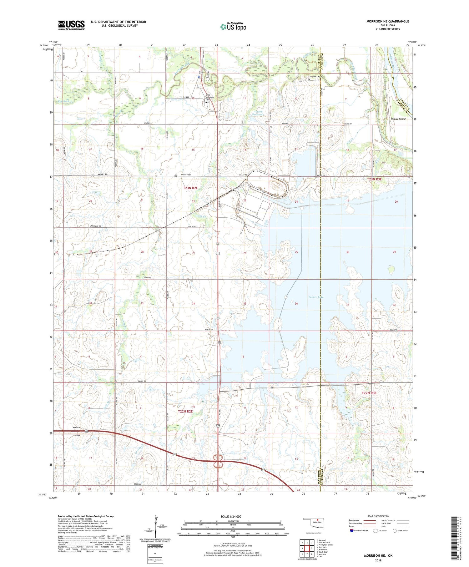
2018 topographic map quadrangle Morrison NE in the state of Oklahoma. Scale: 1:24000. Based on the newly updated USGS 7.5' US Topo map series, this map is in the following counties: Noble, Pawnee, Osage. The map contains contour data, water features, and other items you are used to seeing on USGS maps, but also has updated roads and other features. This is the next generation of topographic maps. Printed on high-quality waterproof paper with UV fade-resistant inks.
Quads adjacent to this one:
West: Red Rock
Northwest: Marland
North: Ponca City SE
Northeast: Prettyhair Creek
East: Watchorn
Southeast: Lela
South: Morrison
Southwest: Black Bear
Contains the following named places: Bird Creek, Cat Creek, Cleghorn Cemetery, Coon Creek, East Noble Division, Houston Creek, Long Branch, Longbranch Site 7a Dam, Longbranch Site 7a Reservoir, Oknoname 103008 Dam, Oknoname 103008 Reservoir, Oknoname 113026 Dam, Oknoname 113026 Reservoir, Otoe - Missouria Cemetery, Otoe Missouria Police Department, Otoe-Missouria Indian Agency, Otoe-Missouria Oklahoma Tribal Statistical Area, Sooner Lake, Township of Missouri, Township of Otoe