MyTopo
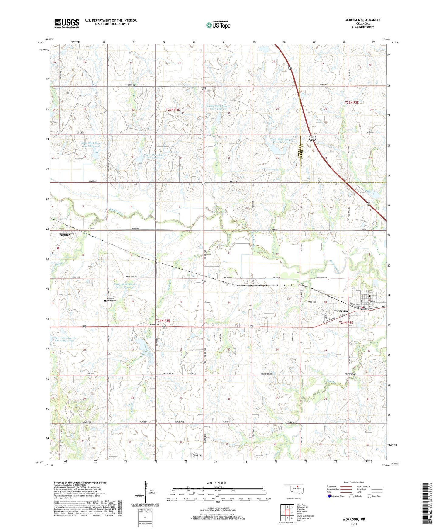
Morrison Oklahoma US Topo Map
Couldn't load pickup availability
2022 topographic map quadrangle Morrison in the state of Oklahoma. Scale: 1:24000. Based on the newly updated USGS 7.5' US Topo map series, this map is in the following counties: Noble, Pawnee. The map contains contour data, water features, and other items you are used to seeing on USGS maps, but also has updated roads and other features. This is the next generation of topographic maps. Printed on high-quality waterproof paper with UV fade-resistant inks.
Quads adjacent to this one:
West: Black Bear
Northwest: Red Rock
North: Morrison NE
Northeast: Watchorn
East: Lela
Southeast: Glencoe
South: Stillwater North
Southwest: Lake Carl Blackwell
This map covers the same area as the classic USGS quad with code o36097c1.
Contains the following named places: Bills Corner, Morrison, Morrison Elementary School, Morrison High School, Morrison Middle School, Morrison Post Office, Morrison Volunteer Fire Department, Mule Creek, Otoe Creek, Petes Corner, Pleasant Valley Cemetery, Spring Creek, Sumner, Sumner Census Designated Place, Sumner Rural Fire District, Town of Morrison, Township of Auburn, Upper Black Bear Creek Site 2 Dam, Upper Black Bear Creek Site 2 Reservoir, Upper Black Bear Creek Site 5 Dam, Upper Black Bear Creek Site 5 Reservoir, Upper Black Bear Creek Site 6 Dam, Upper Black Bear Creek Site 6 Reservoir, Upper Black Bear Creek Site 7 Dam, Upper Black Bear Creek Site 7 Reservoir, Upper Black Bear Creek Site 75 Dam, Upper Black Bear Creek Site 75 Reservoir, Upper Black Bear Creek Site 8 Reservoir, ZIP Code: 73061