MyTopo
Nuyaka Oklahoma US Topo Map
Couldn't load pickup availability
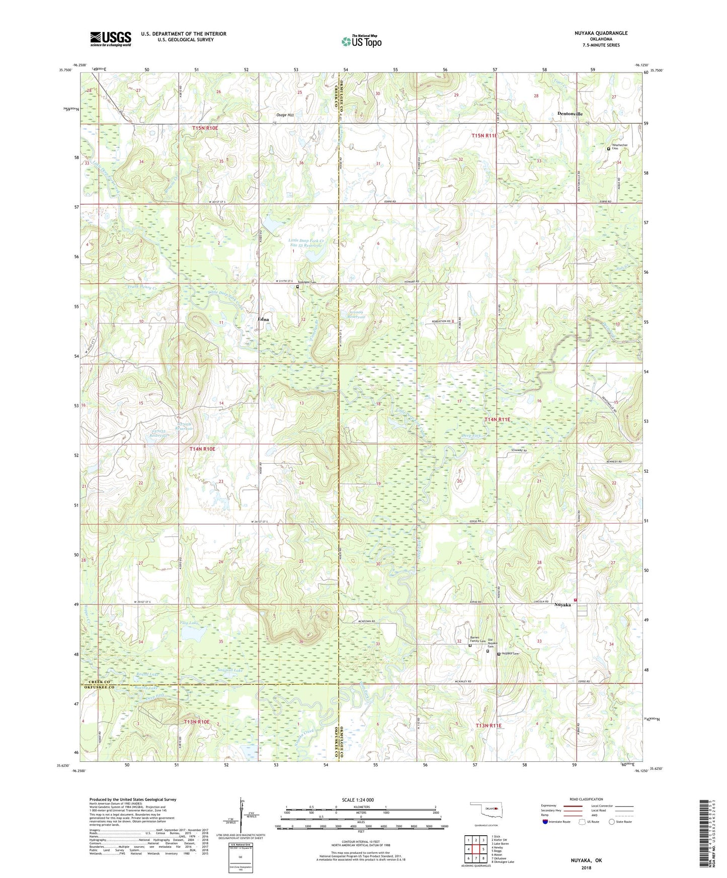
2022 topographic map quadrangle Nuyaka in the state of Oklahoma. Scale: 1:24000. Based on the newly updated USGS 7.5' US Topo map series, this map is in the following counties: Okmulgee, Creek, Okfuskee. The map contains contour data, water features, and other items you are used to seeing on USGS maps, but also has updated roads and other features. This is the next generation of topographic maps. Printed on high-quality waterproof paper with UV fade-resistant inks.
Quads adjacent to this one:
West: Newby
Northwest: Slick
North: Kiefer SW
Northeast: Lake Boren
East: Beggs
Southeast: Okmulgee Lake
South: Okfuskee
Southwest: Mason
This map covers the same area as the classic USGS quad with code o35096f2.
Contains the following named places: Barnes Family Cemetery, Browns Creek, Brushy Lake, Comelys Branch, Dentonville, Edna, Flag Lake, Frank Henry Creek, Greater Mount Zion Church, Isparhecher Cemetery, Little Deep Fork Creek, Little Deep Fork Creek Site 53 Dam, Little Deep Fork Creek Site 53 Reservoir, New Nuyaka Cemetery, Nuyaka, Nuyaka Creek, Nuyaka Fire Department, Oak Grove Church, Oknoname 037055 Dam, Oknoname 037055 Reservoir, Oknoname 037056 Dam, Oknoname 037056 Reservoir, Oknoname 037057 Dam, Oknoname 037057 Reservoir, Oknoname 111009 Dam, Oknoname 111009 Reservoir, Old Nuyaka Cemetery, Power House Church, Round Lake, Salt Creek, Sawmill Lake, Shady Grove Church, Tiger Creek, Town of Slick, Township of Pascoe, Tuskegee Cemetery, Tuskegee Church