MyTopo
Lake Boren Oklahoma US Topo Map
Couldn't load pickup availability
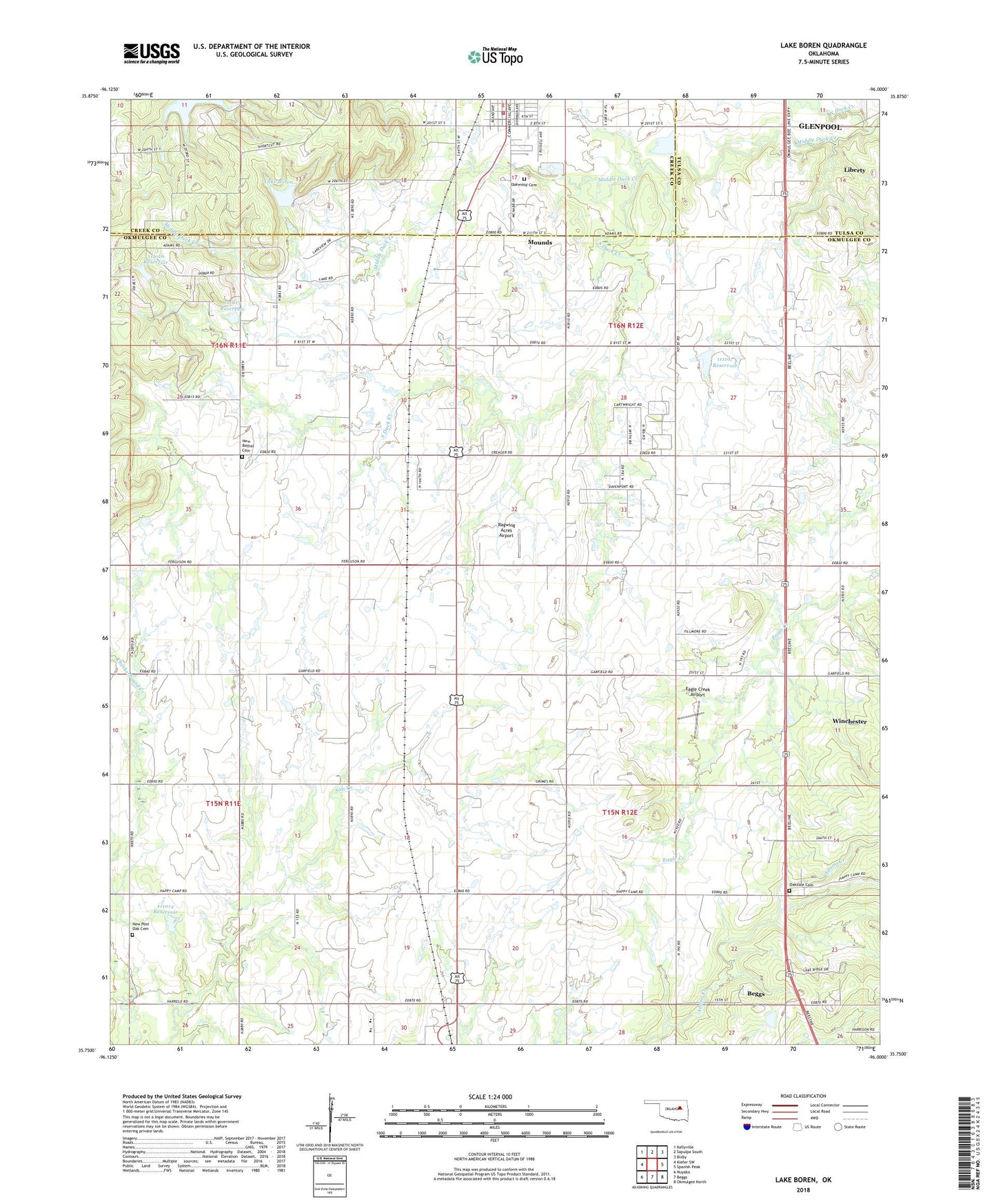
2022 topographic map quadrangle Lake Boren in the state of Oklahoma. Scale: 1:24000. Based on the newly updated USGS 7.5' US Topo map series, this map is in the following counties: Okmulgee, Creek, Tulsa. The map contains contour data, water features, and other items you are used to seeing on USGS maps, but also has updated roads and other features. This is the next generation of topographic maps. Printed on high-quality waterproof paper with UV fade-resistant inks.
Quads adjacent to this one:
West: Kiefer SW
Northwest: Kellyville
North: Sapulpa South
Northeast: Bixby
East: Spanish Peak
Southeast: Okmulgee North
South: Beggs
Southwest: Nuyaka
This map covers the same area as the classic USGS quad with code o35096g1.
Contains the following named places: Ambassador Airport, Beggs Division, Beggs Elementary School, Beggs Middle School, Eagle Creek Airport, KGLB-TV (Okmulgee), KQMJ-FM (Henryetta), KTHK-FM (Okmulgee), Lake Boren, Lake Boren Dam, Lake Jackson, Middle Duck Creek, Mounds Fire Department Station 1 Headquarters, New Bethel Cemetery, New Bethel Church, New Post Oak Cemetery, North Duck Creek, Oakdale Cemetery, Oakwood Cemetery, Oknoname 111012 Dam, Oknoname 111012 Reservoir, Oknoname 111015 Dam, Oknoname 111015 Reservoir, Oknoname 111016 Dam, Oknoname 111016 Reservoir, Oknoname 111017 Dam, Oknoname 111017 Reservoir, Ragwing Acres Airport, South Duck Creek, Town of Mounds, Township of Beggs, ZIP Codes: 74047, 74421