MyTopo
Old Glory Mountain Oklahoma US Topo Map
Couldn't load pickup availability
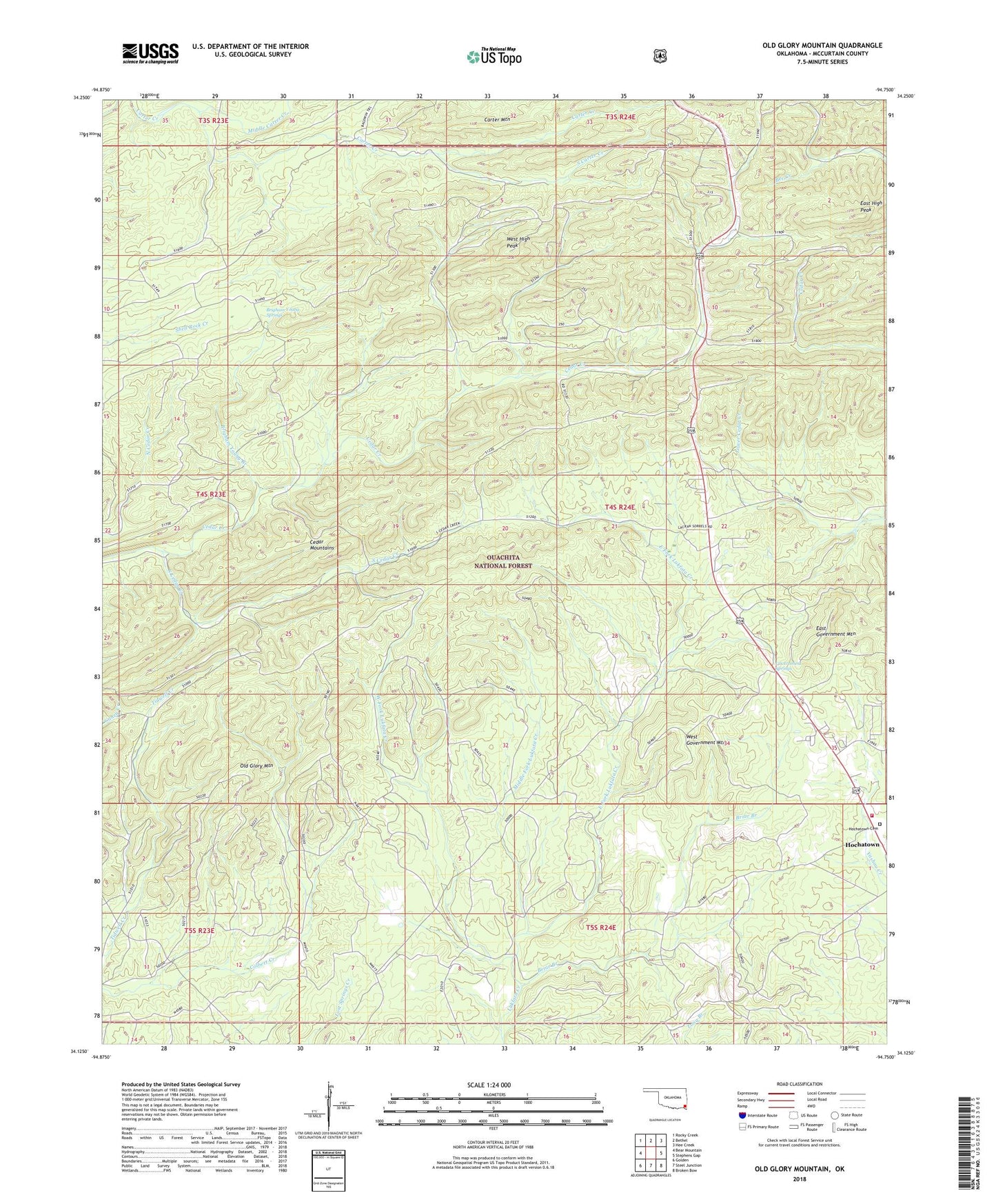
2018 topographic map quadrangle Old Glory Mountain in the state of Oklahoma. Scale: 1:24000. Based on the newly updated USGS 7.5' US Topo map series, this map is in the following counties: McCurtain. The map contains contour data, water features, and other items you are used to seeing on USGS maps, but also has updated roads and other features. This is the next generation of topographic maps. Printed on high-quality waterproof paper with UV fade-resistant inks.
Quads adjacent to this one:
West: Bear Mountain
Northwest: Rocky Creek
North: Bethel
Northeast: Hee Creek
East: Stephens Gap
Southeast: Broken Bow
South: Steel Junction
Southwest: Golden
Contains the following named places: Briar Branch, Brigham Young Branch, Brigham Young Springs, Cedar Mountains, East Fork Lukfata Creek, East Government Mountain, East High Peak, Government Spring, Government Springs, Hochatown, Hochatown Cemetery, Hochatown Volunteer Fire Department, KKBI-FM (Broken Bow), Middle Carter Creek, Middle Fork Lukfata Creek, Okmoname 089009 Reservoir, Oknoname 089009 Dam, Old Glory Mountain, South Carter Creek, South Cedar Creek, West Fork Lukfata Creek, West Government Mountain, West High Peak, ZIP Code: 74728