MyTopo
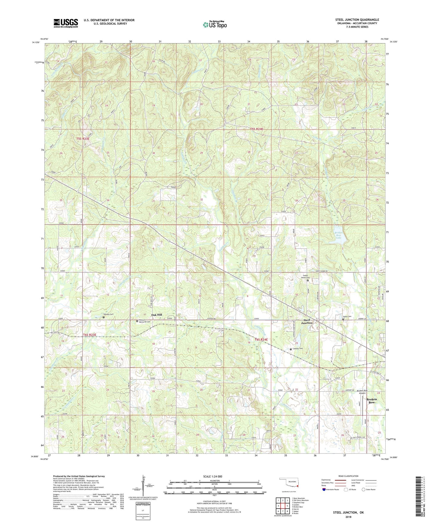
Steel Junction Oklahoma US Topo Map
Couldn't load pickup availability
Also explore the Steel Junction Forest Service Topo of this same quad for updated USFS data
2022 topographic map quadrangle Steel Junction in the state of Oklahoma. Scale: 1:24000. Based on the newly updated USGS 7.5' US Topo map series, this map is in the following counties: McCurtain. The map contains contour data, water features, and other items you are used to seeing on USGS maps, but also has updated roads and other features. This is the next generation of topographic maps. Printed on high-quality waterproof paper with UV fade-resistant inks.
Quads adjacent to this one:
West: Golden
Northwest: Bear Mountain
North: Old Glory Mountain
Northeast: Stephens Gap
East: Broken Bow
Southeast: Shults
South: Idabel
Southwest: Garvin
This map covers the same area as the classic USGS quad with code o34094a7.
Contains the following named places: Broken Bow Airport, Broken Bow City Dam, Broken Bow City Lake, Broken Bow City Lake Dam, Broken Bow Lake, Colbert Chapel, Cumberland Church, Hi-Way Assembly Church, Long Branch, Lukfata Cemetery, Lukfata Church, Lukfata Elementary School, McCurtain County, McCurtain County Fire Training Center, McGee Chapel, Oak Hill, Steel Junction, Stephens Branch, Sweet Home Cemetery, Tohwali Cemetery, Tohwali United Methodist Church, Watsons Memorial Cemetery, Yasho Cemetery, Yasho United Methodist Church