MyTopo
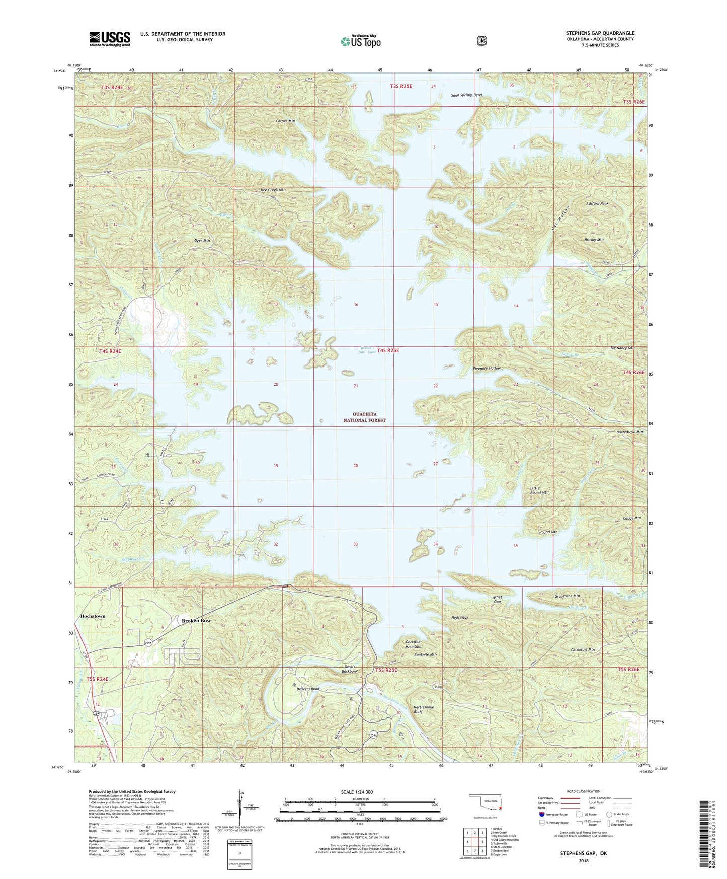
Stephens Gap Oklahoma US Topo Map
Couldn't load pickup availability
Also explore the Stephens Gap Forest Service Topo of this same quad for updated USFS data
2022 topographic map quadrangle Stephens Gap in the state of Oklahoma. Scale: 1:24000. Based on the newly updated USGS 7.5' US Topo map series, this map is in the following counties: McCurtain. The map contains contour data, water features, and other items you are used to seeing on USGS maps, but also has updated roads and other features. This is the next generation of topographic maps. Printed on high-quality waterproof paper with UV fade-resistant inks.
Quads adjacent to this one:
West: Old Glory Mountain
Northwest: Bethel
North: Hee Creek
Northeast: Big Hudson Creek
East: Tablerville
Southeast: Eagletown
South: Broken Bow
Southwest: Steel Junction
This map covers the same area as the classic USGS quad with code o34094b6.
Contains the following named places: Arnet Gap, Ashford Peak, Beaver Creek, Beaver Lodge Nature Trail, Beavers Bend, Beavers Bend State Park, Bee Branch, Bee Creek, Bee Creek Mountain, Biggam Creek, Boji Creek, Broken Bow Dam, Broken Bow Lake, Brushy Mountain, Burke Branch, Calahan Lake, Candy Mountain, Carnasaw Mountain, Carper Mountain, Carson Creek, Carson Creek Recreation Area, Cat Hollow, Cedar Creek, Cedar Creek Recreation Area, County District 2, Devils Backbone, Dry Branch, Dyer Creek, Dyer Mountain, Egypt Creek, Fivemile Hollow, Grapevine Mountain, Hickory Branch, High Peak, Hochatown Census Designated Place, Hochatown State Park, Lamas Branch, Little Round Mountain, Lower Cedar Creek, Nancy Branch, North Bee Creek, North Cedar Creek, North Otter Creek, Otter Creek, Rattlesnake Bluff, River Bend Recreation Area, Rockpile Mountain, Rookpile Mountain, Rough Branch, Round Mountain, Sand Springs Bend, Stephens Creek, Stephens Gap, Stephens Gap Branch, Stephens Gap Recreation Area, Walford Creek